Product Description
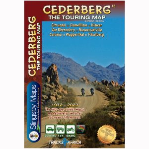
This latest edition of the Slingsby Cederberg Touring Digital Map now extends northwards to the Hantam and Knersvlakte flower-fields – Vanrhynsdorp, Nieuwoudtville, Loeriesfontein and Calvinia.
After compiling extensive field research, we drove nearly every road and track. Along the way, we spoke with locals—farmers, researchers, and adventurers—gathering insights that make this map an essential, detailed companion for exploring the area.
Side One: Cederberg Highlights
Explore the Cederberg from Gifberg in the north to Op die Berg in the south. This includes towns such as Clanwilliam, Citrusdal, Piketberg, Wupperthal, Porterville, and Eendekuil. The Slingsby Cederberg Touring Digital Map is at a scale of 1:160,000. The map details the Cederberg and Koue Bokkeveld ranges with 20 m contour intervals, elevation coloring, and spot heights.
The map clearly differentiates roads by surface type, while marking private sections, mountain passes, petrol stations, and parking areas for easy navigation.
Attractions and Facilities
Use the Slingsby Cederberg Touring Digital Map to locate accommodation options, including hotels, lodges, B&Bs, hostels, campsites, and caravan parks. Additionally, find sports facilities such as golf, horse riding, mountain biking, paragliding, and climbing clearly marked. Additionally, hiking trails, game viewing, fossil sites, and other points of interest are included. GPS waypoints and a latitude/longitude grid at 5’ intervals aid navigation.
Side Two: Northern Extension
Continue your journey north to Loeriesfontein, Nieuwoudtville, Calvinia, Klawer, and Vanrhynsdorp. At 1:200,000, the map details the Bokkeveld Plateau, stretching from the Knersvlakte to the Hantam and Roggeveld, which forms the heart of South Africa’s spring flower wonderland.
Overview Map
Additionally, the Slingsby Cederberg Digital Map provides a general West Coast overview at 1:1,500,000. It shows the mountains and coastal Sandveld. Towns, routes, and key points of interest are highlighted, including the Hantam National Botanical Garden near Nieuwoudtville.
Key Features:
- Explore the Cederberg region with the Slingsby Cederberg Touring Digital Map: Bokkeveld Plateau extends north at 1:200,000.
- Easily navigate all roads, from national highways to 4×4 routes, with minor road conditions clearly indicated for both wet and dry weather.
- Access GPS coordinates at every major junction.
- Explore a range of attractions, including mountain biking, horse riding, hiking, river rafting, and golf, while also visiting nature reserves, farm stalls, historic sites, and wine estates.
- Locate tourism offices, police stations, and accommodations (lodges, backpackers, campsites) with contact numbers.
- Identify Wilderness Areas and conservancy boundaries.
- Reference the West Coast map (1:1,500,000) from Atlantic Ocean to Karoo. It covers Loeriesfontein to Moorreesburg.
- Explore a photographic map of the Cederberg mountains, where all prominent peaks are clearly labeled for easy reference.
How to Download Your Digital Maps
We supply our digital maps in 300 dpi JPG format, packaged as a single ZIP file (57 MB). Please be patient—large files take time to load.
After you complete checkout or send proof of EFT payment, you will automatically receive an email with download instructions. The JPG files are not password protected, so access is simple.
You may download each purchased ZIP file a maximum of two times.
Important Notes on Using Our Digital Maps
- Our digital maps are snapshots of our paper maps. They are not interactive—enlarging them or removing elements (e.g., title pane) does not reveal more mapped area. However, you can enlarge or reduce them within their 300 dpi resolution.
- iPhone users: Some iPhones store images in the Cloud, requiring downloads each time you access a map. To avoid this, consider installing a flash memory card so maps remain immediately available, even in areas without Wi-Fi or phone reception. This issue appears uncommon on Android devices, but user feedback is appreciated.
- Recommendation: Download your digital maps to a laptop or other hard drive before transferring them to a tablet or smartphone.
- Important: Digital products are non-returnable. Once delivered, we cannot verify whether files have been fully deleted from your devices—please understand and be fair.


 Tracks4Africa
Reviews
There are no reviews yet.