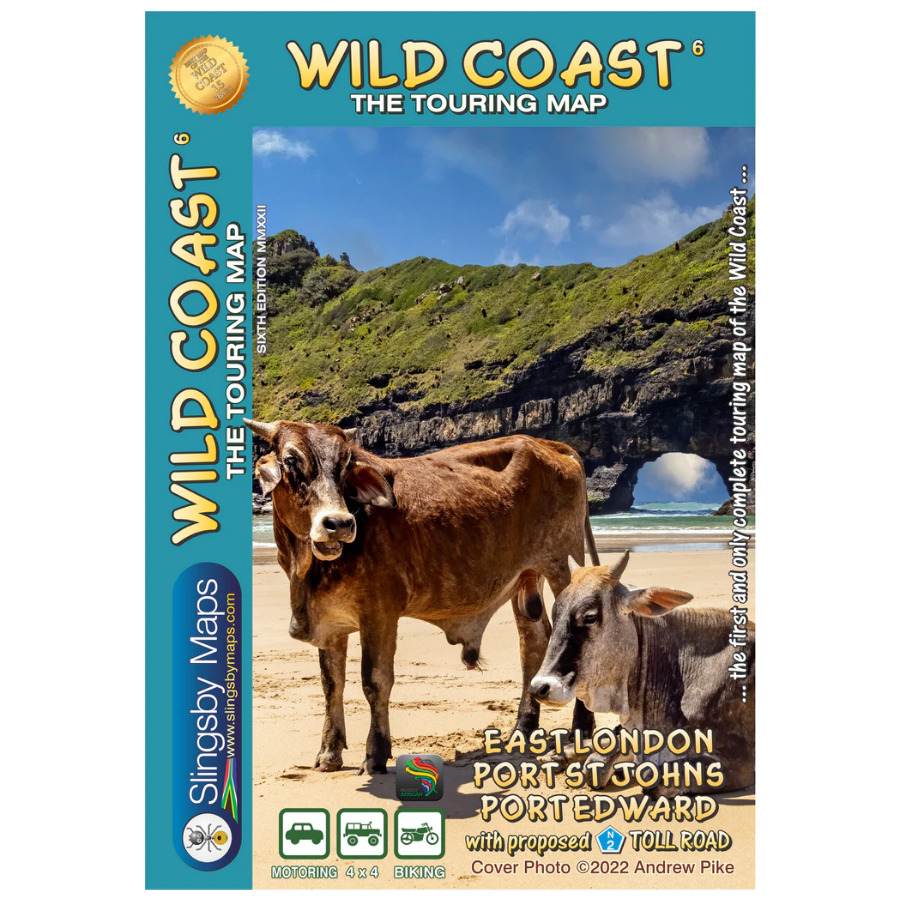

The Slingsby Wild Coast Map covers the whole area from the coast to the N2 as far north as Mthatha, including the mighty Bawa Falls, the unbelievable Collywobbles, and the Mandela Museum at Qunu. The complex geog- raphy of the Wild Coast has always made access difficult – this is the map that has been designed to make exploration possible.
Discover the Wild Coast
Explore a wilderness paradise along South Africa’s Indian Ocean coast, between East London and the KwaZulu-Natal border. Over 100 lagoons thread the coast, while pristine beaches, plunging waterfalls, and deep river valleys invite adventure. The Wild Coast Map depicts historic landscape, birthplace and resting place of Nelson Mandela, is where visions were dreamed, battles were fought, and ships met dramatic ends.
Detailed, Durable Map
Presented at 1:200,000 scale, this waterproof, tear-resistant, double-sided Slingsby Wild Coast Map is fully contoured and GPS compatible. It clearly shows all roads, from highways to local tracks, with eight classifications indicating surface type, wet-weather conditions, and public access. Scenic routes, petrol stations, and GPS waypoints at key junctions make planning effortless.
Packed with Tourist Information
Find accommodation from hotels to campsites, restaurants, picnic sites, arts and craft centres, recreational areas, game and bird-watching spots, missions, medical facilities, and more. Coastal features on the Slingsby Wild Coast Map include leisure sites and shipwrecks, with dates noted.
Insets and Enlargements
Navigate the Wild Coast Map with confidence using an inset of main roads connecting the coast to the N2 and four detailed enlargements: the Jikeleza Route with Inkwenkwezi Game Reserve, Morgan Bay and Kei Mouth, Coffee Bay, and Port St Johns. Additional insets show Mgawa Falls and a street plan of Chintsa East.
Key Features:
- Water and tear resistant in plastic sleeve.
- Cover the full 300 km sweep of the Transkei Wild Coast (East London to Port Edward) at 1:200,000 scale
- The Slingsby Wild Coast Map shows all roads, from National Highways to minor gravel tracks, with 10 classifications to guide route planning
- Displays distances between junctions and provide GPS coordinates for every road junction
- Highlights key landmarks—schools, clinics, stores, radio masts, and police stations with contact numbers
- The Slingsby Wild Coast Map includes airstrips and the latest N2 Toll Road route information
- Shows the Nelson Mandela Legacy Bridge and tarred road to Mvelo
- The Slingsby Wild Coast Map presents all tourism accommodation with contact details
- Marks recreational opportunities: hiking, horse riding, mountain biking, surfing, and fishing
- Notes nearly 100 shipwrecks, many with historical details are on the Wild Coast Map
- Major river catchments and waterfall heights are indicated on the Slingsby Wild Coast Map
- Highlights important 19th-century battlefields


 Tracks4Africa
Dominic Thorburn (verified owner) –
This is brilliant comprehensive map with an incredible amount of detail and information. The addition of QR codes add another layer of useful info. Unrivalled in every way!