


Product Description
One map that does it all! If you plan to travel to a collection of the most popular overland destinations in Southern Africa, then you have to consider the Kavango Zambezi Transfrontier Conservation Area Map (KAZA) paper map 1st Edition. Notably, the KAZA paper map refers to the world’s largest transfrontier land-based conservation area.
Coverage
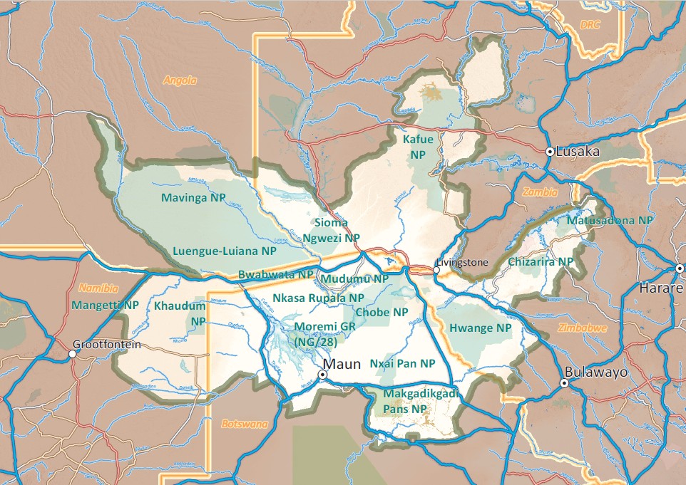
The Kavango Zambezi Transfrontier Conservation Area (KAZA) is the world’s largest transfrontier land-based conservation area. Spanning the borders of five southern African countries – Angola, Botswana, Namibia, Zambia and Zimbabwe – covering an area of over 519 000 sq km, it’s (200 387 sq miles) and boasting three UNESCO World Heritage Sites, it’s a treasure trove of natural and cultural wonders.
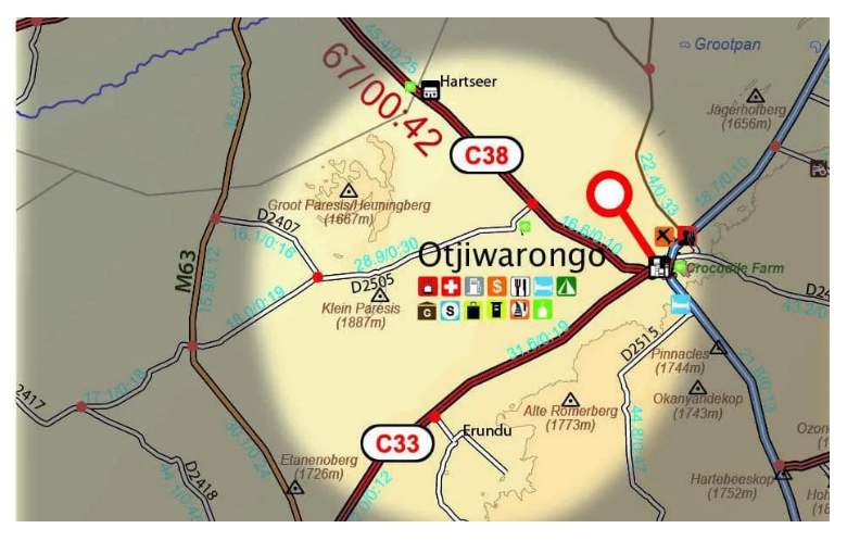
Take note of the map extent and country coverage here:
Have a look at our Paper Map Series video (note: our KAZA Paper Map is not featured in here yet)
Highlights
The Kavango Zambezi Transfrontier Conservation Map (KAZA) showcases Southern Africa’s widest range of safari experiences. It highlights must-see destinations such as Mosi-oa-Tunya Falls (Victoria Falls), the Okavango Delta, and Tsodilo Hills—these are all UNESCO World Heritage Sites.
Moreover, the 1st Edition KAZA Paper Map spans from Kafue National Park in the north to Makgadikgadi in the south. Additionally, it stretches from Windhoek in the west to Kariba in the east. This makes it an essential guide to the region’s top self-drive destinations.
Key features:
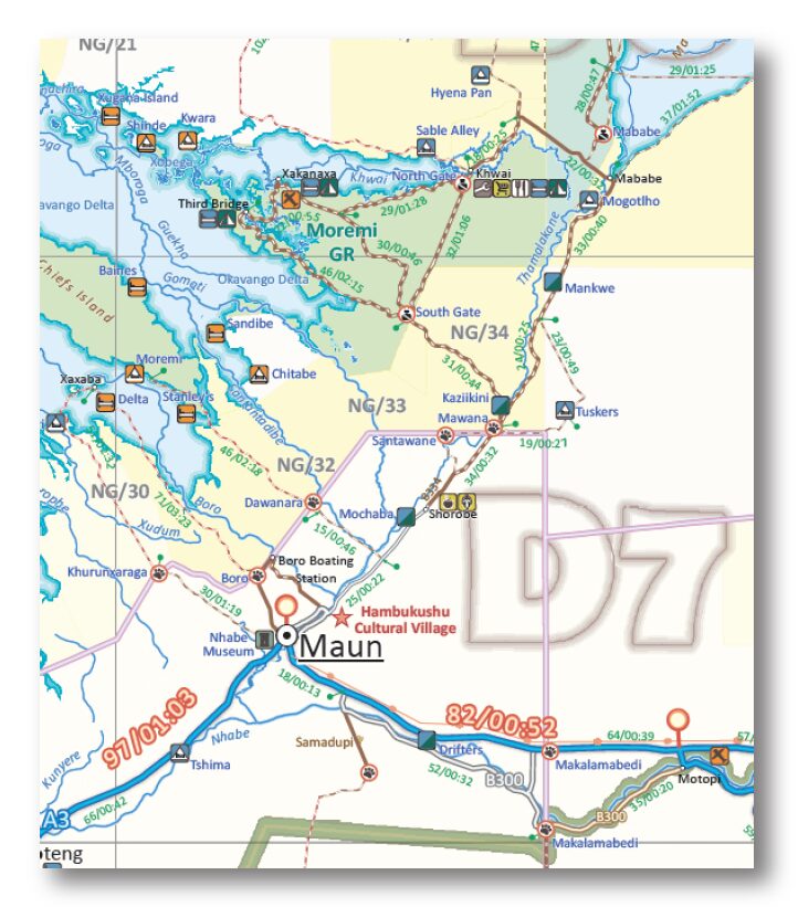
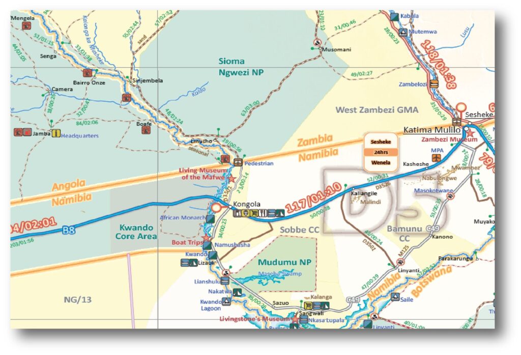
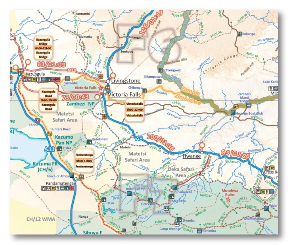
- Scale 1:1,000,000 (1cm = 10km)
- Distances and travel times along all roads
- All roads have been driven by the Tracks4Africa community
- Printed on water and tear resistant PolyArt
Whether you’re aiming to spot the Big 5, add 600 bird species to your life list, or simply relax under an African sunset in a Mokoro, KAZA paper map delivers it all. Moreover, it combines thrilling wildlife encounters with unforgettable moments of peace, making every journey truly rewarding.
The map includes the parks listed below at a scale of 1:1,000,000, providing a useful overview of their location, main routes and surrounding areas. Please note that this is a regional touring map rather than a detailed individual park map.
- Central Kalahari GR (Botswana)
- Chobe NP (Botswana)
- Hwange NP (Zimbabwe)
- Kafue NP (Zambia)
- Liuwa Plain NP (Zambia)
- Lower Zambezi NP (Zambia)
- Luengue-Luiana NP (Angola)
- Mana Pools NP (Zimbabwe)
- Matusadona NP (Zimbabwe)
- Mavinga NP (Angola)
- Nxai Pan NP (Botswana)
- Savuti (Botswana)
- Sioma Ngewzi NP (Zambia)


 Tracks4Africa
Eduard de Koning (verified owner) –
Speedy delivery and high quality map. Can’t wait to start using it, hopefully very soon!