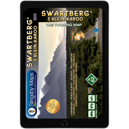
Product Description
The Swartberg & Klein-Karoo Touring Digital Map at 1:160,000 scale delivers detailed topographic coverage from west to east. It clearly highlights key towns such as Laingsburg, Prince Albert, Ladismith, Oudtshoorn, Barrydale, and George. Therefore, it allows you to plan your route with ease. Perfect for any Swartberg & Klein-Karoo Touring Digital Map enthusiast.
Discover the Mighty Swartberg Mountains
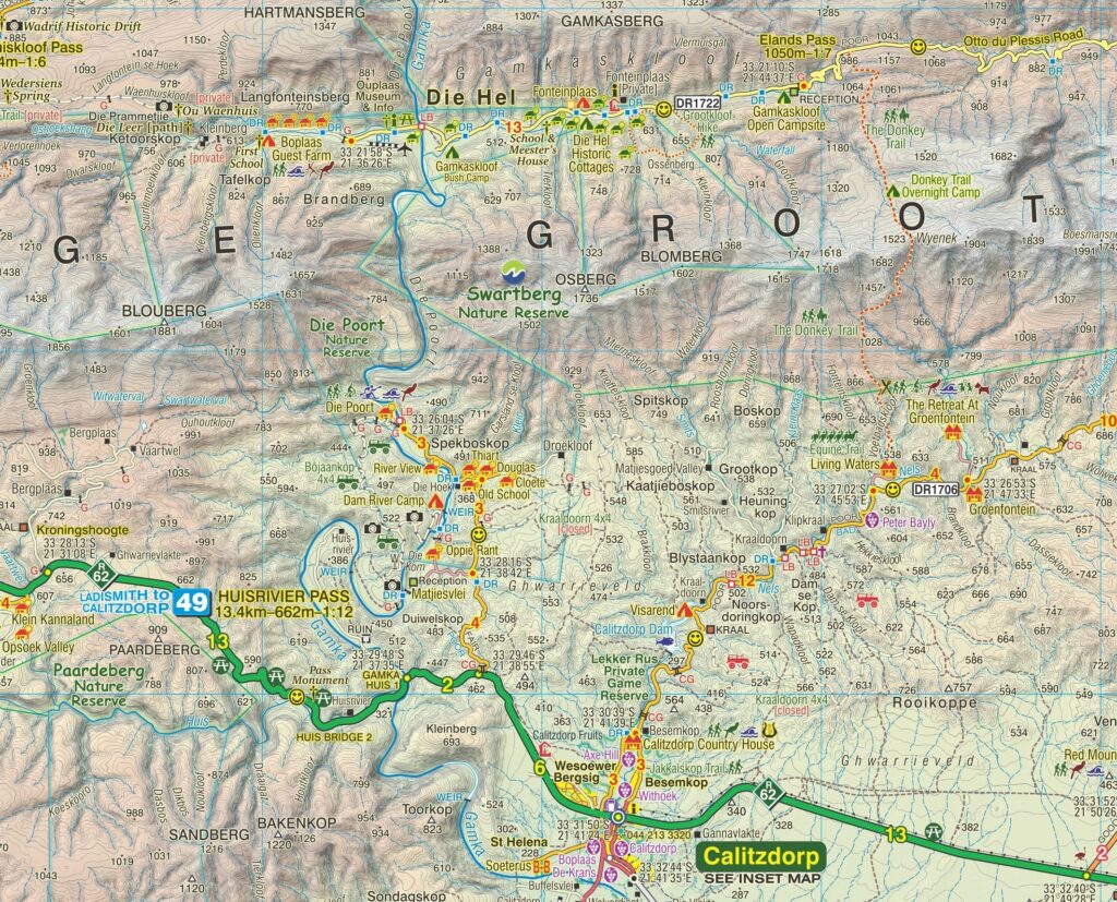
Rising to 2,400 metres, the Swartberg commands attention as the Western Cape’s most dramatic range. It features striking ravines, poorts, and mountain passes. Furthermore, it borders the northern Klein-Karoo, adding natural beauty, cultural richness, and exciting opportunities for using the Swartberg & Klein-Karoo Touring Digital Map to explore.
Uncover a Playground of Nature and Adventure
Visitors can explore a wide range of activities—from ostrich farms and wildlife parks to the famous Cango Caves. In addition, the Swartberg & Klein-Karoo Touring Digital Map highlights outdoor and cultural attractions. These cater to both casual travelers and avid adventurers.
Navigate with Precision
The Swartberg & Klein-Karoo Touring Digital Map provides detailed topography, including altitude coloring, 20m contour intervals, shading, and spot heights. It also enhances GPS navigation by marking major road junctions and landmarks with waypoints. Furthermore, it includes 5’ latitude and longitude lines to assist in your journey.
Travel Every Road, Know Every Surface
The map includes all roads—from major highways to 4WD tracks—and clearly classifies surface types, access (public or private), cattle grids, game gates, and fuel stops. Moreover, the Swartberg & Klein-Karoo Touring Digital Map highlights both scenic and less interesting routes. This helps you make informed decisions.
Make the Most of Every Stop
Hiking trails are clearly marked on the Swartberg & Klein-Karoo Touring Digital Map, while symbols identify accommodation, campsites, picnic areas, farm stalls, wineries, restaurants, wildlife viewing spots, and recreational sites. This gives you everything needed for a rewarding journey with your digital map.
Perfect for Self-Drive Adventures
Specifically designed for independent travellers, this durable, waterproof map helps you explore the Swartberg and Klein-Karoo with confidence. The Swartberg & Klein-Karoo Touring Digital Map offers reliable guidance through one of South Africa’s most captivating regions, making self-drive adventures exciting.
Key Features:
- Located in the Western Cape, South Africa.
- The Swartberg & Klein-Karoo Touring Digital Map shows all roads, from national highways to minor gravel routes. Moreover, clear classifications indicate road quality. This helps you plan your route effectively.
- Explore the Swartberg and Klein-Karoo region with this contoured, GPS-compatible map from Slingsby Maps. At 1:160,000 the scale features detailed topography, rich tourist info, and street plans for ten main towns.
- The Swartberg & Klein-Karoo Touring Digital Map includes street plans of ten main towns—Laingsburg, Ladismith, Van Wyksdorp, Calitzdorp, De Rust, Oudtshoorn, Schoemanshoek, Prince Albert, Uniondale, and Willowmore. Each is annotated with accommodation, tourist facilities, and points of interest.
- No less than 28 mountain passes are shown — all are public roads!
- Distances are clearly shown; comprehensive 4 x 4 information aids your exploration.
- GPS coordinates in DD MM SS format are provided for every road-junction.
- All tourism facilities and accommodation establishments are shown in the out-of-town areas; there are insets of the major towns.
- The Swartberg & Klein-Karoo Touring Digital Map links with our Baviaanskloof, Garden Route, Overberg, and Tankwa-Karoo maps for easy trip planning.
How to Download Your Digital Maps
We supply our digital maps in 300 dpi JPG format, packaged as a single ZIP file (67 MB). Please be patient—large files take time to load.
After you complete checkout or send proof of EFT payment, you will automatically receive an email with download instructions. The JPG files are not password protected, so access is simple. Especially when accessing the Swartberg & Klein-Karoo Touring Digital Map, simplicity is key for accessing South Africa’s captivating region.
You may download each purchased ZIP file of our Day Drives from Cape Town Digital Map a maximum of two times.
Important Notes on Using Our Digital Maps
- Our digital maps are snapshots of our paper maps. They are not interactive—enlarging them or removing elements (e.g., title pane) does not reveal more mapped area. However, you can enlarge or reduce them within their 300 dpi resolution.
- iPhone users: Some iPhones store images in the Cloud, requiring downloads each time you access a map. To avoid this, consider installing a flash memory card so maps remain immediately available, even in areas without Wi-Fi or phone reception. This issue appears uncommon on Android devices, but user feedback is appreciated.
- Recommendation: Download your digital maps to a laptop or other hard drive before transferring them to a tablet or smartphone.
- Important: Digital products are non-returnable. Once delivered, we cannot verify whether files have been fully deleted from your devices—please understand and be fair.


 Tracks4Africa
Reviews
There are no reviews yet.