South Africa: Hike and Climb the Cederberg, including Rocklands – Digital (Edition 5)

R382.50

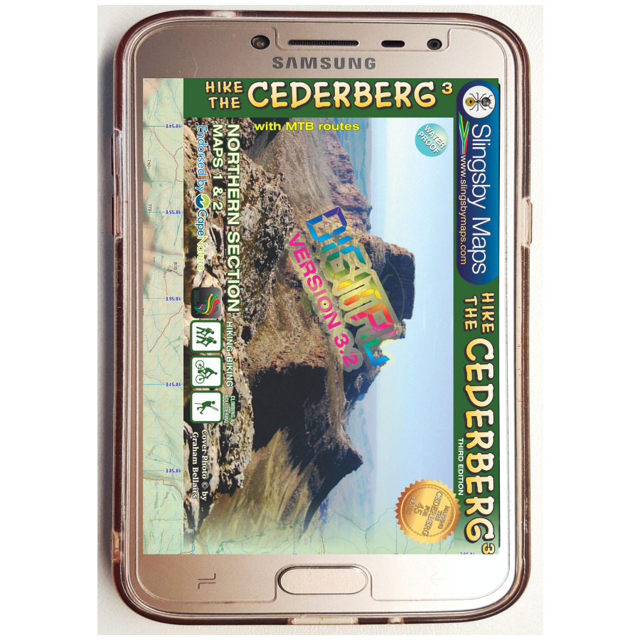
These maps are FABULOUS when loaded on a Smart Phone, Tablet or iPad…online or offline!

The most up-to-date version of our famous Hike the Cederberg map set in digital format.

Location: Western Cape, South Africa

Unleash Your Adventure: The Revised Edition 5 Has Arrived!

The updates in this version to fuel your wanderlust are:

  • Over 200 new bouldering sites added – discover hidden climbing gems!
  • Official CapeNature trail names and codes – making your journey easier to navigate and even more memorable.

There are two double-sided A1-sized maps in the set (i.e., four maps in all), covering the entire Cederberg Wilderness and extending north to Wolfdrif and south to Mount Ceder.

The maps are not available separately.

More than a hundred hikers, mountaineers, conservationists and locals have contributed their special knowledge to the project, which has been proudly endorsed by CapeNature.

Every single public footpath has been researched on foot, and the maps include distances between path junctions, as well as GPS coordinates, altitudes, etc. etc.


SKU: SLBY-CEDDH4 Categories: , Tag:

Product Description

Our digital maps are supplied in 300 dpi jpg format. Files are uploaded as a single Zip file. PLEASE BE PATIENT; LARGE FILES TAKE TIME TO LOAD. Download size: 75Mb

After you have made your checkout payment [or we’ve received your POP for your EFT], you’ll get an automatic email with download instructions. Simple as that! [but be aware that some files are large, so allow plenty of time for the download!].

You will be allowed a maximum of two downloads per product  [Zip file] purchased.

IMPORTANT NOTES ABOUT DIGITAL MAPS
1. Our digital maps are effectively snapshots of our paper maps. They are not interactive [enlargement does not reveal greater detail] nor does removing elements, eg title pane, reveal more mapped area. That said, they can be enlarged or reduced to the limits of their resolution [300 dpi] with complete flexibility.
2. iPHONES: We have recently been made aware that some iPhones store picture content in the Cloud, not on the phone, necessitating downloads every time you want to use the map. Seems that Apple wasn’t thinking about the vast areas of the earth with no wifi or phone reception. Work around this by installing a flash memory card in your phone if possible, so that the maps are always immediately available. This problem does not seem to occur on Android and other phones, as far as we know. Any info from users would be very helpful!
3. Please remember our recommendation: that you download your digital purchases to a laptop or other hard drive before transferring them [if required] to a tablet or smartphone.
4. Please note that digital products are NOT RETURNABLE! How could we possibly know whether they have been completely erased from all your devices? Please be fair!

Whether you’re a seasoned climber or just starting your bouldering journey, this edition is your ultimate companion to explore and experience the great outdoors like never before.

The maps also detail:

  • Popular bouldering sites, as well as the complex of fine mountain biking trails around Dwarsrivier/Sanddrif and other locations
  • Caves, perennial water, pools, dramatic rock formations and sites of historical importance (but caves that have rock art are not shown except in supervised situations such as the Sevilla Trail)
  • The famous Cederberg shalebands, dense vegetation, cedar plantations, prominent rock screes and rockfalls, OVER 12 000 TREES!! etc etc
  • The best places to stay from which your hikes might be launched, with their telephone numbers

We spent many delightful days enjoying the warm hospitality of the local communities, gathering more than 500 authentic place names which have never appeared on any maps before. We can proudly claim that these are the best and most definitive hiking maps of the Cederberg ever produced.

Additional info:

Cederberg Mountains in the Western Cape Province on a set of two double-sided, waterproof and tear-resistant, GPS compatible hiking maps at 1:40,000 from Slingsby Maps, providing a vivid picture of the topog- raphy with hiking trails and detailed road network, tourist facilities and places of interest, etc.

The set shows the Cederberg Mountain range, complementing the publishers’ wider coverage of the Cederberg region on a touring map at 1:160,000. Contours at 20m intervals, enhanced by relief shading, altitude colouring, plus colouring and/or graphics for different types of terrain and vegetation, provide an excellent representation of the topography. Various ranges, peaks and passes are named and lots of additional spot heights are marked. An overprint highlights various hiking trails, indicating head trails, permit requirements, waymarking for special routes, etc. Also marked are tracks and footpaths not recommended for hikers.

Road network indicates untarred roads, 4WD routes or roads requiring high clearance, private roads where owners’ permission may be required, etc. Important junctions and other locations are annotated with GPS waypoints. Symbols indicate various facilities and places of interest including various types of tourist accommodation (lodges, guest houses, B&Bs, campsites, etc), restaurants, picnic places, local arts and crafts shops, petrol stations, wineries, sport and recreational facilities, etc. In addition to the GPS waypoints the maps have a latitude and longitude grid at intervals of 1’.

Don’t miss out—grab your copy today and start charting your next adventure!

Additional Information

Current Version

2021

Reviews

There are no reviews yet.

Only logged in customers who have purchased this product may leave a review.

IMPORTANT: READ ME BEFORE YOU PROCEED

1. After downloading these files you might consider backing them up, to avoid losing them through accidental deletion.

2. Your purchase of these files, whether maps or texts, implies your acceptance that copyright in these products is solely vested in Tracks4Africa. High resolution password protected pdf files may not be printed. You may print the other files or extracts from them on a personal printer for your own use, but you may not copy any files to third parties, nor reproduce them in publications or any other way without the written permission of the relevant authors. Email all requests to sales@tracks4africa.co.za

3. If your purchase includes photographs in jpg, tif or pdf format, you may use these in any way you wish including in publications for resale, on internet sites, etc etc, provided that if so used you include the words “Photo[s] by Tracks4Africa”.

4. Enjoy your digital products! Your feedback is welcome: write to us at the email above.