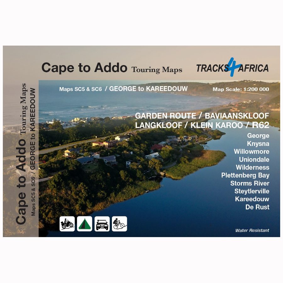
Description
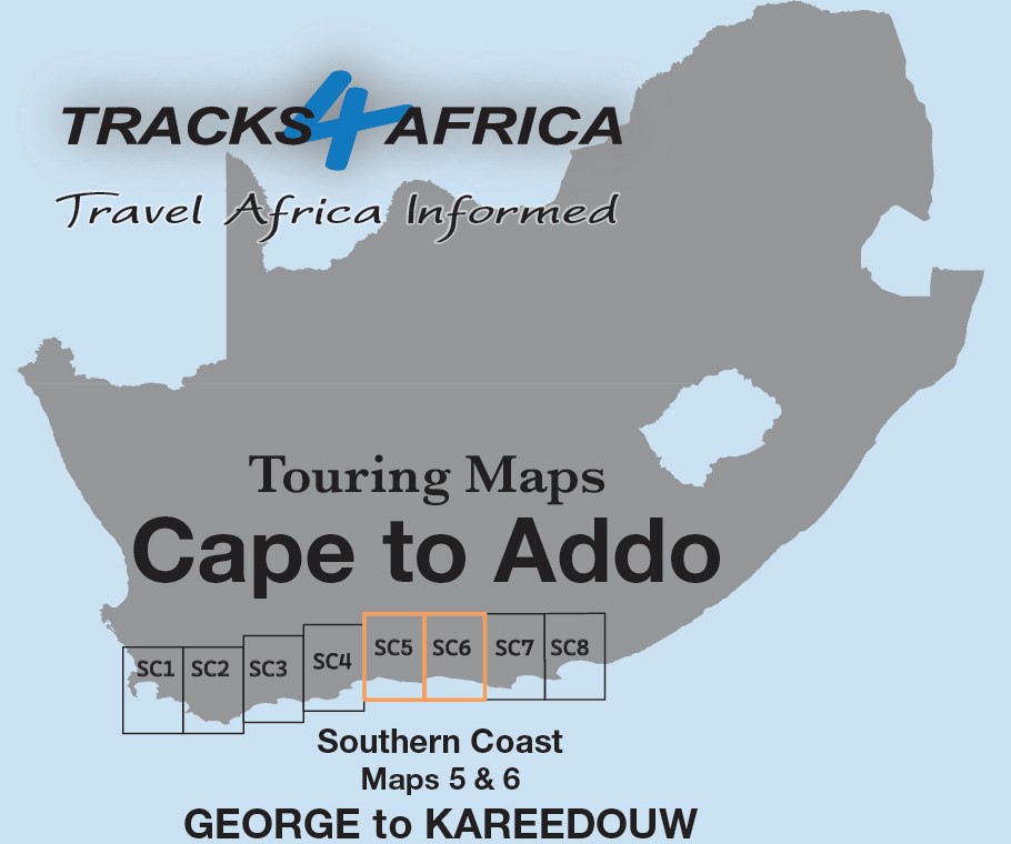
The Cape to Addo map series covers the southern parts of the Western Cape of South Africa. It does this in a series of eight highly detailed maps. These maps are printed on four sheets of A1 durable paper.
The SC5 & SC6 : George to Kareedouw maps are the third 2 mapsets in this series.
Ideal for All Types of Road Trips
These maps are ideal for day drives, overlanding, or road trips by sedan, 4WD, or motorbike. They guide you along the scenic southern coast, through the Klein Karoo, and into the greater Karoo.
We start in Cape Town and travel east along the southern coast through the Overberg, Winelands, and Garden Route. We also visit Klein Karoo R62 and Baviaanskloof. The journey ends at Addo National Park and Gqeberha.
Exploring the SC5 & SC6 Maps: Highlights, Landscapes, and Adventures
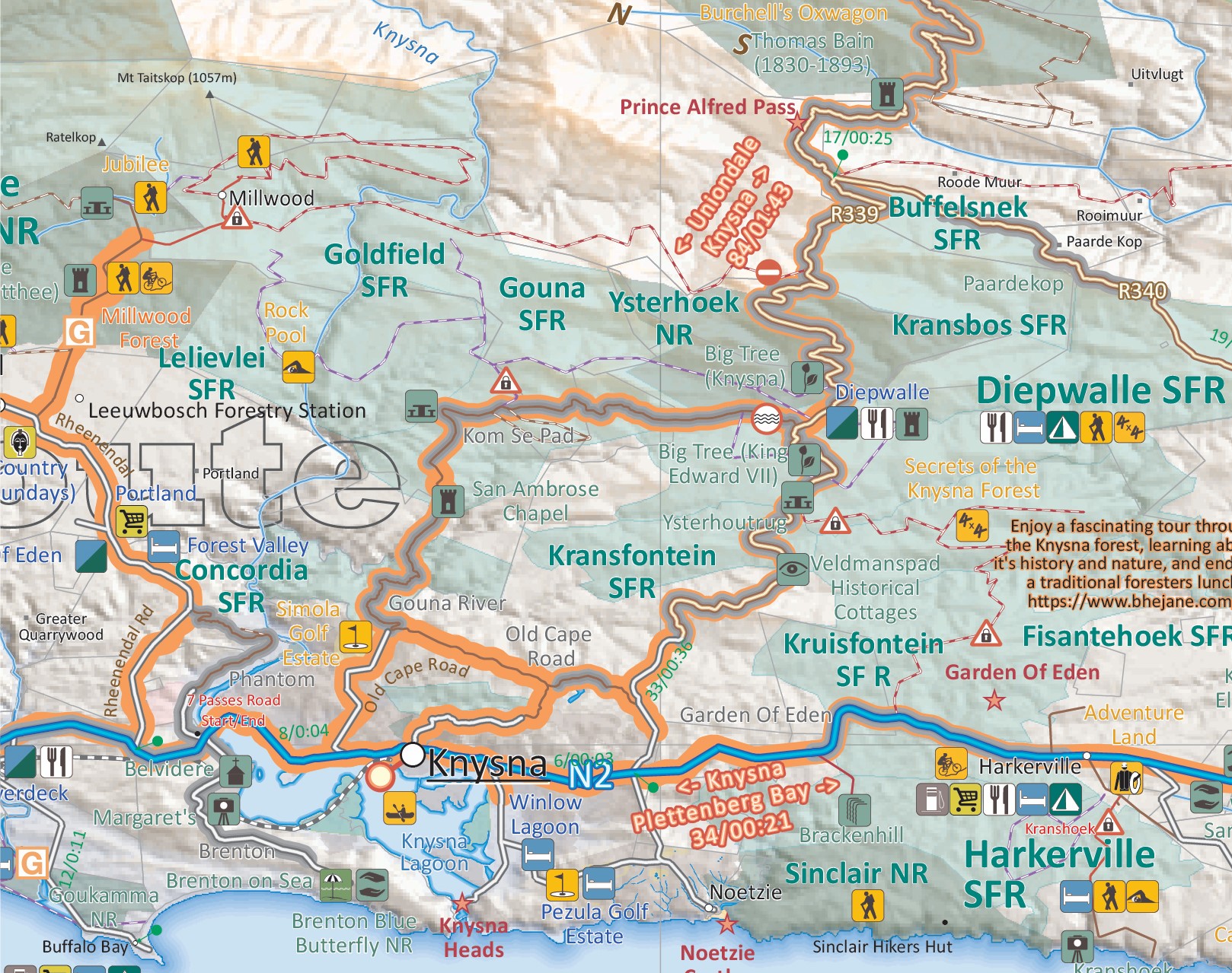
As the name suggests, the SC5 & SC6 : George to Kareedouw maps span from George to Kareedouw, bordered by the coast in the south and Karoo towns to the north. They cover the diverse region from the Karoo to the coast, showcasing the famous Garden Route alongside hidden gems like Langkloof Valley and the rugged Baviaanskloof wilderness, popular with hikers, bikers, and 4WD adventurers.
Diverse Landscapes and Scenic Highlights
The landscape on the SC5 & SC6 : George to Kareedouw map ranges from lush forests and deep valleys to dramatic mountain passes and warm Indian Ocean beaches. Between George and Plettenberg Bay, the coastline offers some of South Africa’s most stunning, swim-friendly beaches.
Along the Garden Route, green forests stretch between George and Storms River Mouth; meanwhile, the historic Seven Passes Road, built by Thomas Bain, invites exploration, and the iconic Otter Trail offers a renowned multi-day coastal hike from Storms River Mouth to Nature’s Valley.
Adventure and Activities
Tourists can explore the famous Knysna Lagoon and Heads by boat or thrill-seek with the world’s highest bridge bungy jump at Bloukrans Bridge near Nature’s Valley.
For camping, pitch a tent at Ebb & Flow in Wilderness or right on the ocean’s edge at Storms River Mouth.
Over 10 years, the Tracks4Africa community recorded and verified every road by GPS. As a result, the SC5 & SC6 : George to Kareedouw map accurately shows roads, landmarks, distances, and travel times.
In fact, the T4A paper map series is likely the world’s first comprehensive country map to offer travel time information. This is true for the entire road network, whether on tar, gravel, or sand!
Key features:
- The 1:200,000 scale offers detailed routes, trails, and points of interest—perfect for self-drive travellers.
- The compact size makes it ideal for road trips.
- We use durable Duraflex paper and print two maps per A1 sheet, creating a four-sheet series. Additionally, each map comes in its own protective plastic sleeve.
- Mountain passes are highlight.
- Like other Tracks4Africa maps, these show both drive times and distances. Adventure bikers will value the detailed gravel roads and listed accommodation options.
- The SC5 & SC6 : George to Kareedouw map include a relief background that highlights farm boundaries, protected areas, and key features for clarity.
- For each town, we indicate basic services like fuel, shops, and camping. Additionally, we highlight facilities and activities available at various nature reserves.
- Key areas of interest include the Garden Route between George and Storms River Mouth, Baviaanskloof wilderness area, Langkloof Valley and parts of the Klein Karoo.
- Prominent towns on these maps include George, Knysna, Willowmore, Uniondale, Wilderness, Plettenberg Bay, Storms River, Steytlerville and Kareedouw.
- What you see on the SC5 & SC6 : George to Kareedouw map is exactly what you get on T4A GPS Maps
- Map designed to suit the needs of self-drive travellers
- Visit www.tracks4africa.com for detail on places of interest
Get the full set!


 Tracks4Africa
Reviews
There are no reviews yet.