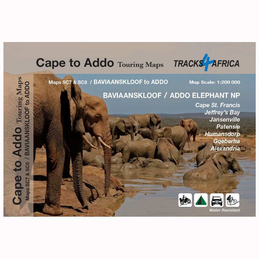
Description
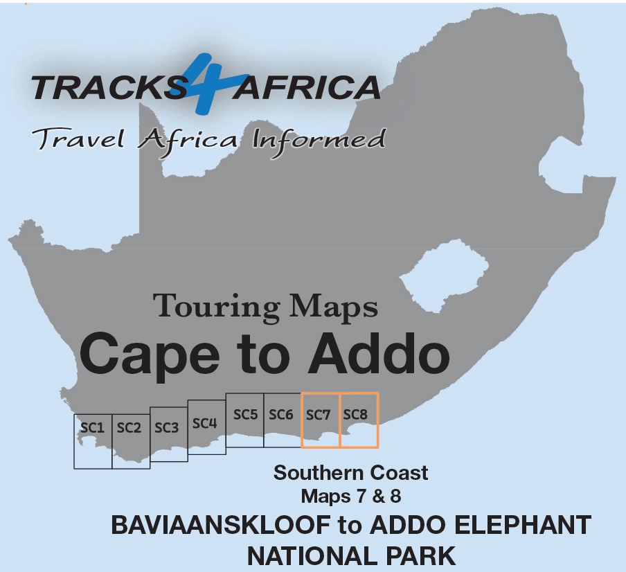
The Cape to Addo map series covers the southern parts of the Western Cape of South Africa. It does this in a series of eight highly detailed maps. These maps are printed on four sheets of A1 durable paper. The SC7 & SC8 : Baviaanskloof to Addo maps are the fourth 2 mapsets in this series.
Ideal for All Types of Road Trips
The SC7 & SC8 : Baviaanskloof to Addo maps are ideal for day drives, overlanding, or road trips by sedan, 4WD, or motorbike. They guide you along the scenic southern coast, through the Klein Karoo, and into the greater Karoo.
We start in Cape Town and travel east along the southern coast through the Overberg, Winelands, and Garden Route. We also visit Klein Karoo R62 and Baviaanskloof. The journey ends at Addo National Park and Gqeberha.
Explore the Eastern Cape: Addo, Baviaanskloof & the Garden Route
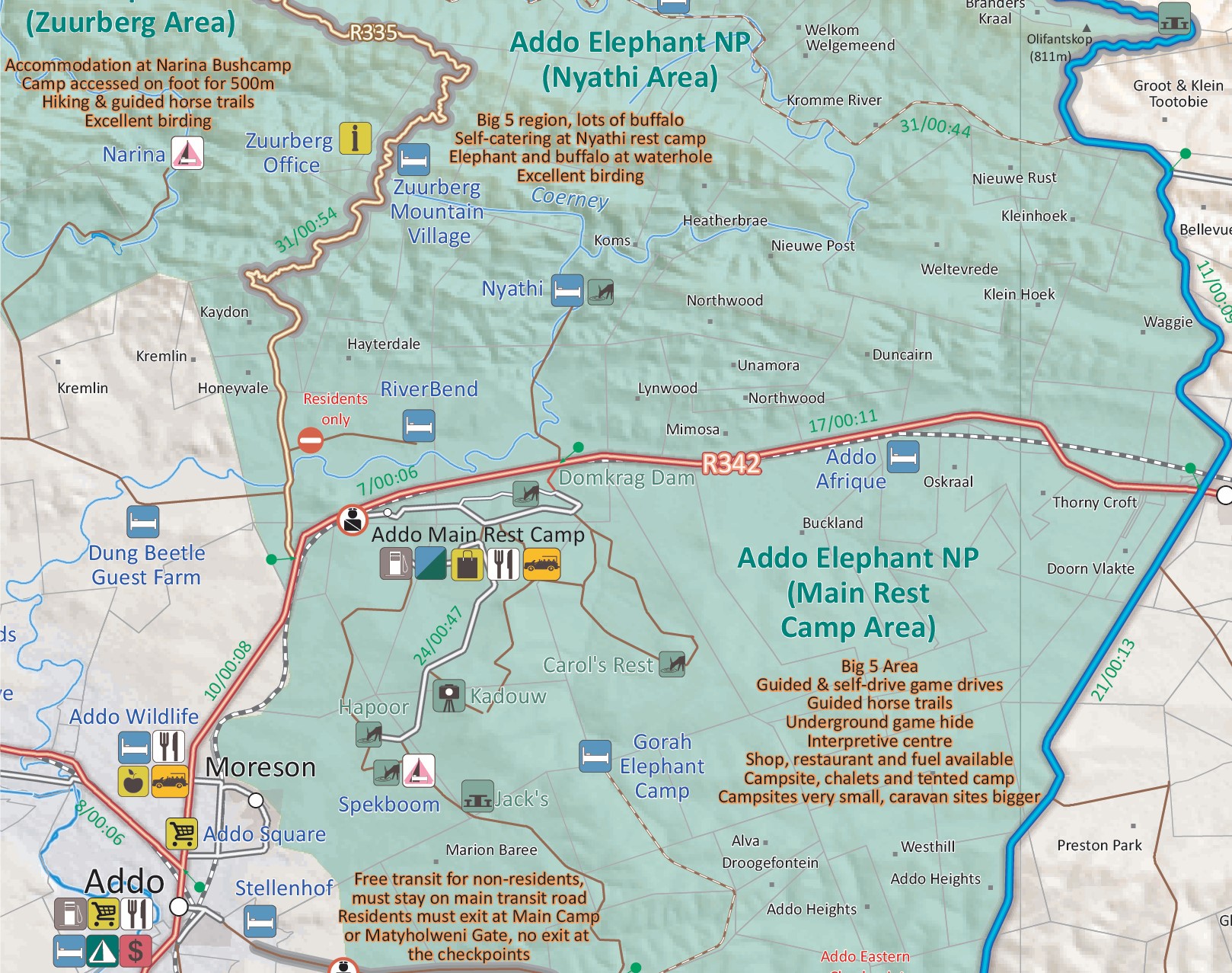
The Addo Elephant National Park is world famous and forms the main feature on these two maps. Along with it we cover the eastern section of the Baviaanskloof and we continue with the Garden Route between Cape St. Francis to Gqeberha (Port Elizabeth).
From Coastline to Inland Towns
The SC7 & SC8 : Baviaanskloof to Addo maps maps are printed on either side of a single sheet of Duraflex paperand stretch from Cape St. Francis in the west to Alexandria in the east. The coastline forms the southern boundary and to the north it includes places like Jansenville and Middleton.
Over 10 years, the Tracks4Africa community recorded and verified every road by GPS. As a result, the SC7 & SC8 : Baviaanskloof to Addo maps accurately shows roads, landmarks, distances, and travel times.
In fact, the T4A paper map series is likely the world’s first comprehensive country map to offer travel time information. This is true for the entire road network, whether on tar, gravel, or sand!
Key features:
- The 1:200,000 scale offers detailed routes, trails, and points of interest—perfect for self-drive travellers.
- The compact size makes it ideal for road trips.
- We use durable Duraflex paper and print two maps per A1 sheet, creating a four-sheet series. Additionally, each map comes in its own protective plastic sleeve.
- Mountain passes are highlight.
- Like other Tracks4Africa maps, these show both drive times and distances. Adventure bikers will value the detailed gravel roads and listed accommodation options.
- The SC7 & SC8 : Baviaanskloof to Addo maps include a relief background that highlights farm boundaries, protected areas, and key features for clarity.
- For each town, we indicate basic services like fuel, shops, and camping. Additionally, we highlight facilities and activities available at various nature reserves.
- Key areas of interest include the eastern section of the Garden Route and the Baviaanskloof. Moreover, the Addo Elephant National Park stands out as a major attraction. Additionally, coastal destinations like Cape St. Francis and Jeffrey’s Bay draw visitors with their world-famous surfing.
- Notably, the maps highlight several prominent towns, including Cape St. Francis, Humansdorp, and Patensie. Furthermore, they feature inland towns such as Jansenville and Kirkwood, as well as coastal hubs like Jeffrey’s Bay and Gqeberha (Port Elizabeth). Additionally, the maps include Kariega (Uitenhage), Paterson, Colchester, and Alexandria, providing comprehensive regional coverage.
- What you see on the SC7 & SC8 : Baviaanskloof to Addo maps are exactly what you get on T4A GPS Maps
- This map is specifically designed to meet the needs of self-drive travellers, offering clear navigation, detailed routes, and essential travel information for independent exploration.
- Visit www.tracks4africa.com for detail on places of interest
Get the full set!


 Tracks4Africa
Reviews
There are no reviews yet.