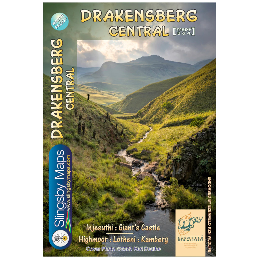


The Slingsby Drakensberg Central Paper Map is the Ultimate Drakensberg Recreation Map!
Decades of Research Behind Every Detail
We have collected data over many years to create the latest edition of this groundbreaking recreational map series of the KZN Drakensberg. Originally conceived in the mid 1970s, it now delivers unparalleled accuracy and detail.
Precision Mapping You Can Trust
Moreover, we have meticulously updated this edition of the Slingsby Drakensberg Central Paper Map with carefully geo-referenced tracks of all approved routes. Additionally, we provide precise coordinates and heights of path junctions. Our maps offer comprehensive difficulty-ratings for escarpment passes and countless other details. Consequently, these features make Slingsby maps truly unbeatable for serious adventurers.
Complete Coverage Across Two Sides
Side One: Northern to Central Range
First, Side One of the Slingsby Drakensberg Central Paper Map covers the spectacular area from Injesuthi southwards. It guides you through the Giants Castle Game Reserve to Highmoor and Mkhomazi Wilderness.
Side Two: Southern Wilderness Areas
Meanwhile, Side Two provides detailed coverage of Highmoor itself and the expansive Mkhomazi Wilderness. Furthermore, this side includes comprehensive mapping of Lotheni and Kamberg. It ensures complete regional coverage.
Key Features:
- Waterproof Protection: We print the Drakensberg Central Paper Map on Duraflex waterproof material to ensure complete weather resistance
- Superior Durability: Additionally, the tear-resistant construction withstands rugged outdoor conditions
- Convenient Storage: Furthermore, we package each Drakensberg Central Paper Map in a protective plastic pocket for easy transport and safekeeping


 Tracks4Africa
Reviews
There are no reviews yet.