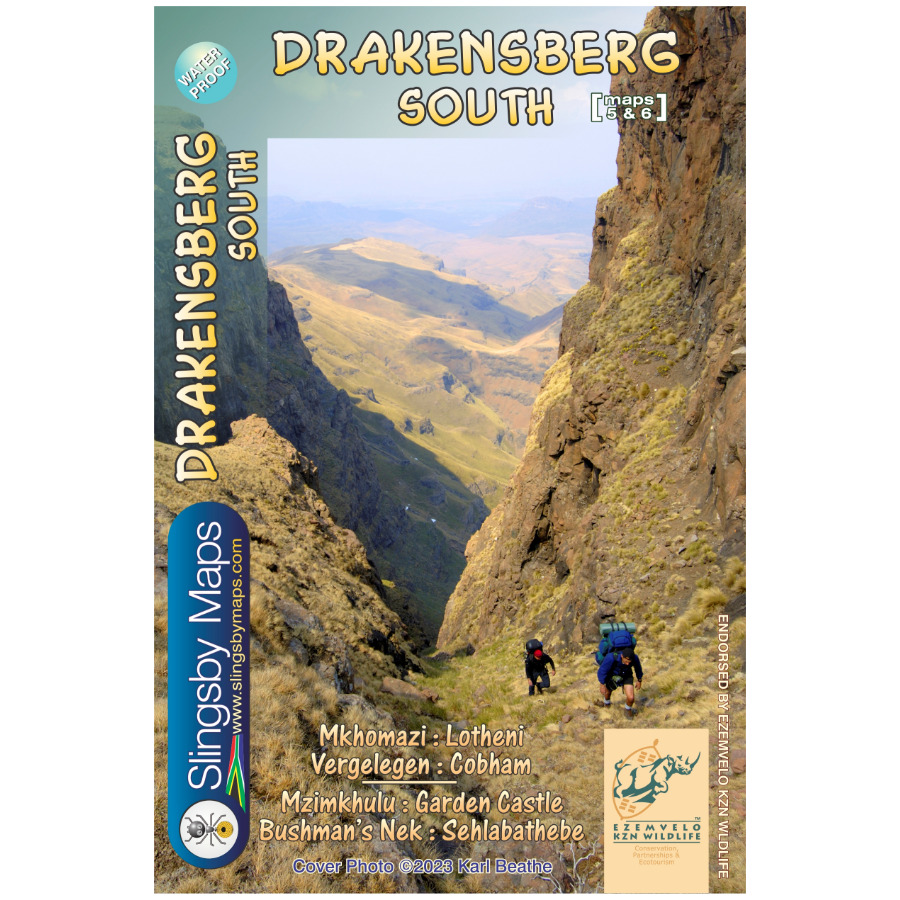


Explore the Southern KZN Drakensberg with our Slingsby Drakensberg South Paper Map.
Side One: Explore the Trails
Side one showcases the area from Lotheni southwards. It takes you through Vergelegen and the Mkhomazi Wilderness, all the way to the iconic Sani Pass and Cobham.
Side Two: Continue the Journey South
Side two of the Slingsby Drakensberg South Paper Map then carries you further south through the Mzimkhulu Wilderness to Garden Castle. From there, it guides you to Bushman’s Nek and into the breathtaking Sehlabathebe National Park.
Built on Decades of Exploration
Experts collected data over many years to create this latest edition of the first-ever recreational map series of the KZN Drakensberg.
Updated and Enhanced Details
Although originally conceived in the mid-1970s, this edition now includes carefully geo-referenced tracks of all approved routes. Moreover, the Slingsby Drakensberg South Paper Map provides coordinates and elevations of path junctions, difficulty ratings for escarpment passes, and many additional features.
Why Choose Slingsby Maps
Because of these precise details, Slingsby maps remain unmatched for navigating and exploring the Drakensberg.
Key Features:
- Printed on Duraflex waterproof material.
- The Drakensberg South Paper Map is at a Map scale of 1:50,000
- We reinforced it to be tear resistant for rugged use.
- Packaged in a protective plastic pocket.
- Finally, we secure credibility as the map is endorsed by Ezemvelo KwaZulu-Natal Wildlife.


 Tracks4Africa
BergAdv (verified owner) –
Same quality of accuracy that the original set Of Slingsby Maps – and printed on water proof paper will out last the current set of Ezemvelo Maps by far.
Great to see Tracks4Africa taking up the challenge and meeting needs of Drakensberg hikers and hope for a long lasting and continued support from all to keep us hiking in the Drakensberg.
KyleB (verified owner) –
Peter Slingsby appears to have sold his map business and right to sell his maps to Tracks4Africa. I truly hope Tracks4 Africa honour Peter Slingsby’s legacy in the way he developed and shared these maps by being truly for the communities who use these maps. He never seemed to be about making money out of these maps. (How can R200 each cover the hours gone into this?) He just genuinely loved what accurate maps like these enabled for so many people.
The North, Central, and Southern berg maps are outstanding. Nothing compares.
Deon van Niekerk (verified owner) –
I recently purchased the three Drakensberg maps.
I am incredibly impressed with the quality and attention to detail that went into creating these maps.
First and foremost, the level of detail on the map is outstanding. It includes not only major landmarks but also smaller points of interest that are often overlooked on other maps.
Furthermore, the fact that the map is presented on waterproof material is a game-changer. If it is exposed to water or moisture it will hold up perfectly.
I would highly recommend it to anyone in need of a reliable and detailed map that can withstand the elements.