
The Slingsby Garden Route Paper Map is the most comprehensive, fully researched, and detailed map of the Garden Route ever published!
Discover More Than Just a Scenic Drive
The Garden Route offers far more than a picturesque national road. You can venture beyond the main highway to uncover its hidden treasures.
Follow the Winding Side Roads
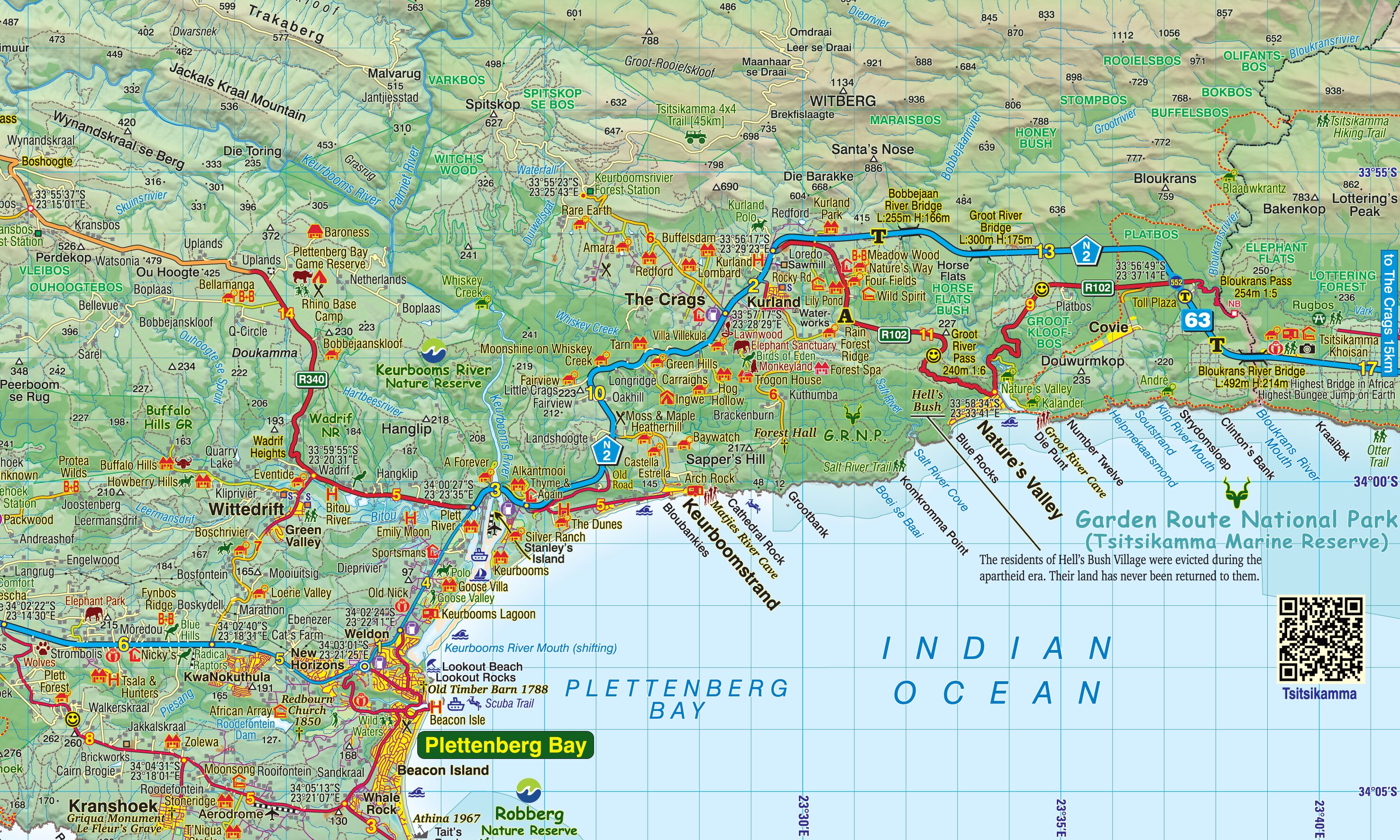
As you explore the intriguing, winding side roads on the Garden Route Touring Map, you will come across charming spots with captivating names. These include locations such as Whiskey Creek, De Vlugt, Phantom Pass, and Noetzie.
Unearth Hidden Wonders
Along these little-known byways, you will find old goldmines, traces of elephants, and enchanting forest trails. The Garden Route Touring Map provides details about each. In addition, you can discover castles perched on beaches. You can also travel along historic mountain passes that whisper tales of the past.
Key features:
- Water and tear resistant in plastic sleeve.
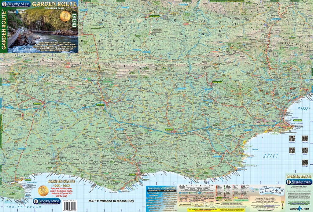
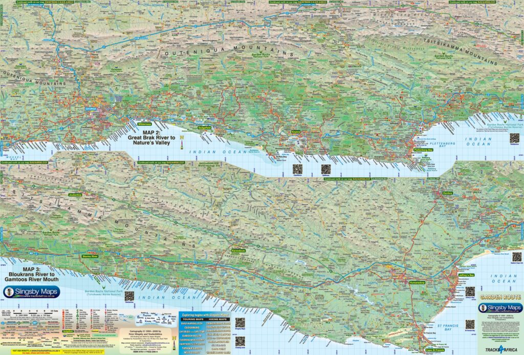
- This is a relief-shaded double-sided map covering the whole of the Western Cape’s official Garden Route Tourism Region. It extends from Heidelberg in the west to Jeffery’s Bay in the east.
- Slingsby Garden Route Paper Map includes the Tsitsikamma and Outeniqua Mountains, and the Langkloof located to the north of them.
- The Garden Route Touring Map shows every road—from national highways to minor dirt tracks and footpaths. Each road’s distance is clearly marked.
- The Garden Route Touring Map includes full GPS coordinates in DD MM SS format. Moreover, it provides these coordinates for all road junctions.
- The map details over 30 attractions, ranging from farm stalls, abseiling, horse riding, and golf courses. It also covers game viewing, botanical gardens, and historical sites. Additionally, it highlights numerous accommodation options, especially those located outside towns.


 Tracks4Africa
ninaderooij@gmail.com (verified owner) –
It is a beautiful map, but to my idea there is a bit too much on it, like all those guesthouses, etc. That makes it a bit unclear.