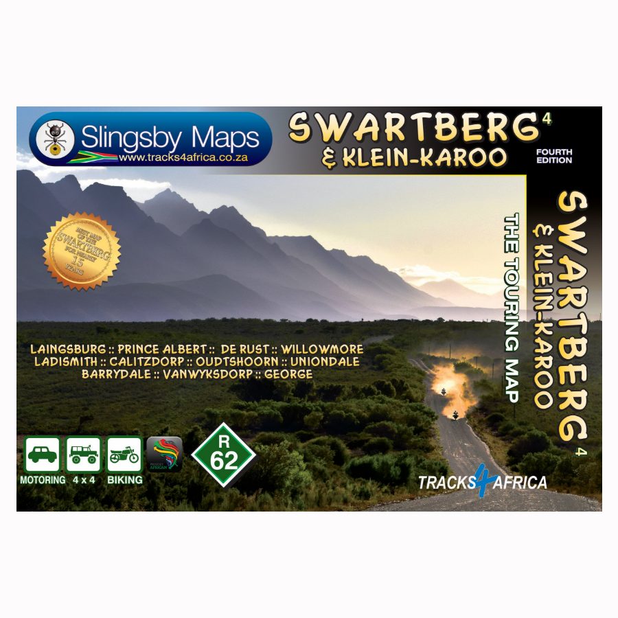
Description
The double-sided Slingsby Swartberg & Klein-Karoo Map at 1:160,000 scale delivers detailed topographic coverage from west to east. It clearly highlights key towns such as Laingsburg, Prince Albert, Ladismith, Oudtshoorn, Barrydale, and George. Therefore, it allows you to plan your route with ease.
Discover the Mighty Swartberg Mountains
Rising to 2,400 metres, the Swartberg commands attention as the Western Cape’s most dramatic range. It features striking ravines, poorts, and mountain passes. Furthermore, it borders the northern Klein-Karoo, adding natural beauty, cultural richness, and exciting opportunities for exploration.
Uncover a Playground of Nature and Adventure
Visitors can explore a wide range of activities—from ostrich farms and wildlife parks to the famous Cango Caves. In addition, the region offers endless outdoor and cultural attractions. These cater to both casual travellers and avid adventurers.
Navigate with Precision
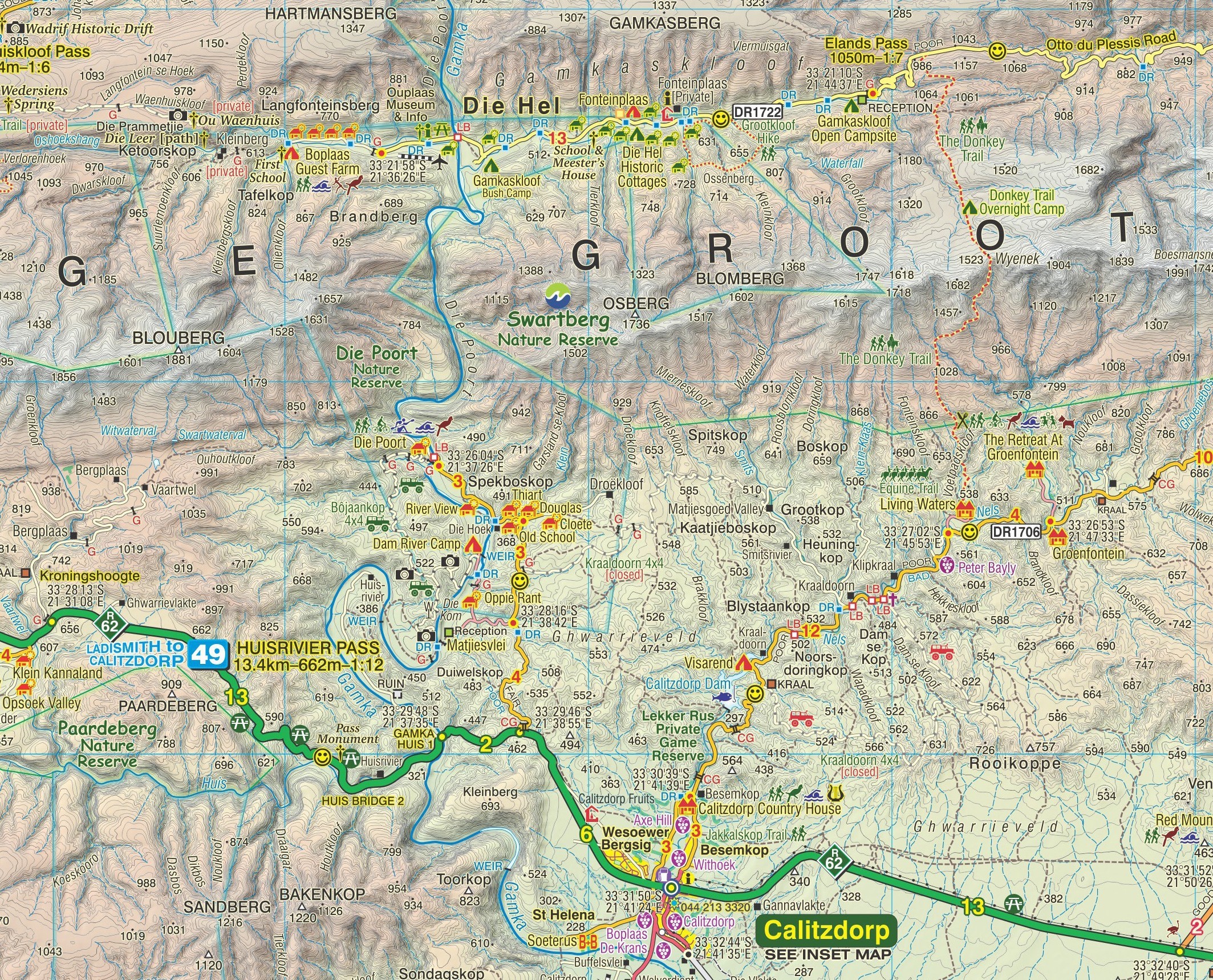
The map provides detailed topography, including altitude colouring, 20m contour intervals, shading, and spot heights. It also enhances GPS navigation by marking major road junctions and landmarks with waypoints. Furthermore, it includes 5’ latitude and longitude lines.
Travel Every Road, Know Every Surface
The map includes all roads—from major highways to 4WD tracks—and clearly classifies surface types, access (public or private), cattle grids, game gates, and fuel stops. Moreover, it highlights both scenic and less interesting routes. This helps you make informed decisions.
Make the Most of Every Stop
Hiking trails are clearly marked, while symbols identify accommodation, campsites, picnic areas, farm stalls, wineries, restaurants, wildlife viewing spots, and recreational sites. This gives you everything needed for a rewarding journey.
Perfect for Self-Drive Adventures
Specifically designed for independent travellers, this durable, waterproof map helps you explore the Swartberg and Klein-Karoo with confidence. It offers reliable guidance through one of South Africa’s most captivating regions.
Key features:
- The Swartberg & Klein-Karoo Touring Map shows all roads, from national highways to minor gravel routes. Moreover, clear classifications indicate road quality. This helps you plan your route effectively.
- Explore the Swartberg and Klein-Karoo region with this contoured, GPS-compatible map from Slingsby Maps. This double-sided, waterproof, tear-resistant map at 1:160,000 scale features detailed topography, rich tourist info, and street plans for ten main towns.
- The Slingsby Swartberg & Klein-Karoo Paper Map includes street plans of ten main towns—Laingsburg, Ladismith, Van Wyksdorp, Calitzdorp, De Rust, Oudtshoorn, Schoemanshoek, Prince Albert, Uniondale, and Willowmore. Each is annotated with accommodation, tourist facilities, and points of interest.
- No less than 28 mountain passes are shown — all are public roads!
- Distances are clearly shown; comprehensive 4 x 4 information
- GPS coordinates in DD MM SS format are provided for every road-junction
- All tourism facilities and accommodation establishments are shown in the out-of-town areas; there are insets of the major towns
- The Slingsby Swartberg & Klein-Karoo Map links with our Baviaanskloof, Garden Route, Overberg, and Tankwa-Karoo maps for easy trip planning.


 Tracks4Africa
ninaderooij@gmail.com (verified owner) –
It’s a beautiful map with lots and lots of interesting details, but there is a bit too much on the map, like guest houses, etc., which makes it a bit muddled. As ownership often changes, this info might be soon out of date.