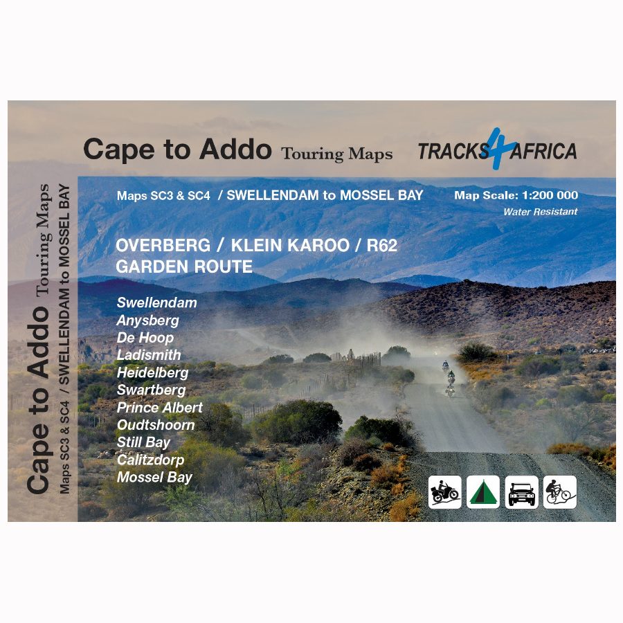
Description
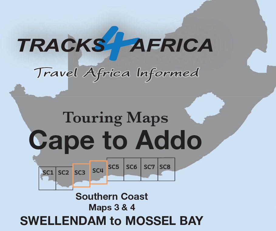
The Cape to Addo map series covers the southern parts of the Western Cape of South Africa. It does this in a series of eight highly detailed maps. These maps are printed on four sheets of A1 durable paper. The SC3 & SC4 : Swellendam to Mossel Bay maps are the second 2 mapsets in this series.
Ideal for All Types of Road Trips
These maps are ideal for day drives, overlanding, or road trips by sedan, 4WD, or motorbike. They guide you along the scenic southern coast, through the Klein Karoo, and into the greater Karoo.
We start in Cape Town and travel east along the southern coast through the Overberg, Winelands, and Garden Route. We also visit Klein Karoo R62 and Baviaanskloof. The journey ends at Addo National Park and Gqeberha.
Explore the Western Cape: Day Trips and Iconic Attractions from Swellendam to Mossel Bay
Durable and Practical Design
We print these SC3 & SC4 : Swellendam to Mossel Bay maps on durable Duraflex paper for long-lasting use. The maps span from Swellendam to Mossel Bay and Oudtshoorn, bordered by the coastline in the south and stretching north to Anysberg Reserve, the N1, and Prince Albert.
Map Coverage: Swellendam to Mossel Bay
The SC3 & SC4 : Swellendam to Mossel Bay map cover a road-tripper’s dream route—perfect for bikes, 4WDs, camper vans, or regular cars. This diverse region offers something for every kind of traveller.
Experience the Charm of the Klein Karoo
Beyond Montagu on the R62, the relaxed Klein Karoo vibe takes over. Along the way, towns welcome you with coffee shops, farm stalls, restaurants, and curio stores—all competing for your attention.
Accommodation for Every Traveller
The SC3 & SC4 : Swellendam to Mossel Bay map features a wide range of accommodation options to suit every budget. This makes it easy to plan overnight stops along your journey.
Uncover Hidden Gems and Scenic Routes
While it lacks Cape Town’s landmarks, this region offers rich natural beauty and distinct adventures. You can whale watch at De Hoop and ride gravel roads into The Hell via the Swartberg. You can also explore the Cango Caves near Oudtshoorn or relax in Mossel Bay’s mild climate.
Rejuvenate Your Soul
With its scenic back roads and tranquil atmosphere, this region invites you to slow down and explore. It’s a unique opportunity to reconnect with the road and yourself.
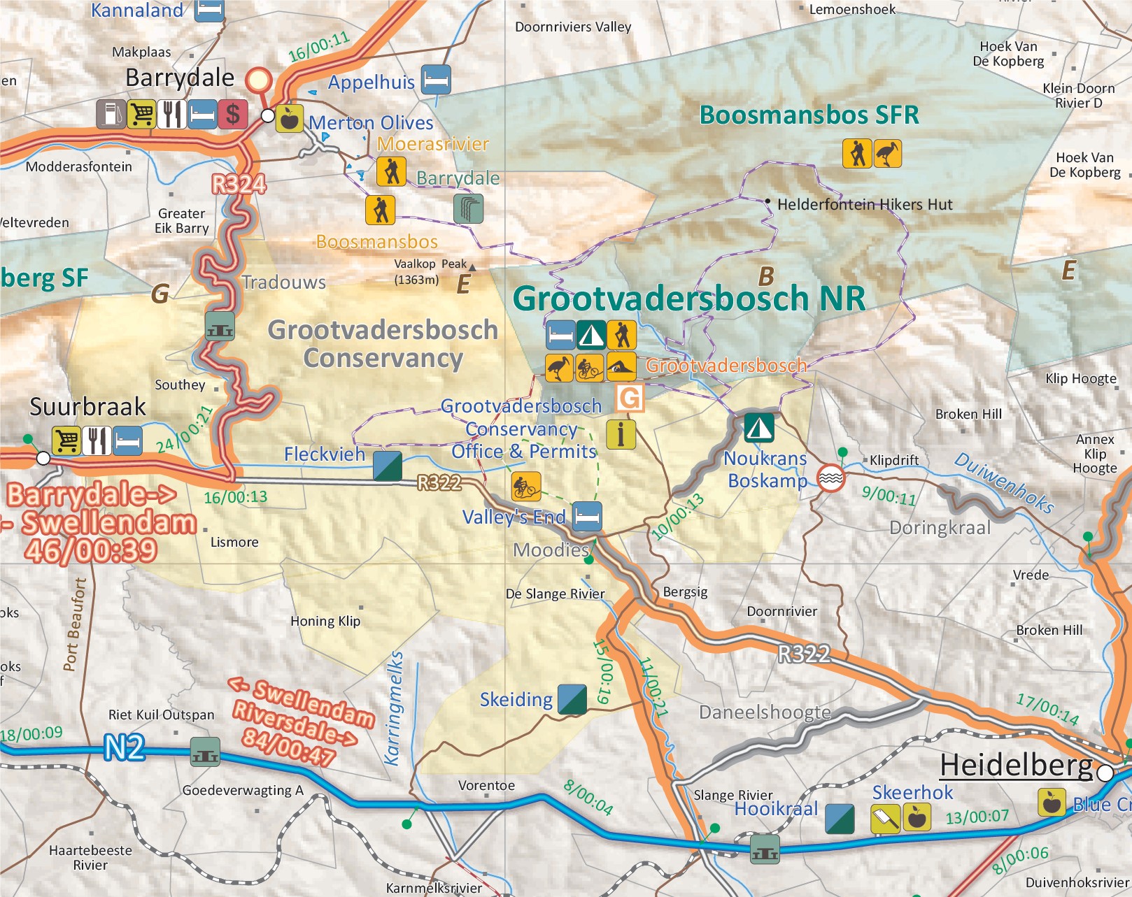
Over 10 years, the Tracks4Africa community recorded and verified every road by GPS. As a result, the SC3 & SC4 : Swellendam to Mossel Bay map accurately shows roads, landmarks, distances, and travel times.
In fact, the T4A paper map series is likely the world’s first comprehensive country map to offer travel time information. This is true for the entire road network, whether on tar, gravel, or sand!
Key features:
- The 1:200,000 scale offers detailed routes, trails, and points of interest—perfect for self-drive travellers.
- The compact size makes it ideal for road trips.
- We use durable Duraflex paper and print two maps per A1 sheet, creating a four-sheet series. Additionally, each map comes in its own protective plastic sleeve.
- Mountain passes are highlight.
- Like other Tracks4Africa maps, these show both drive times and distances. Adventure bikers will value the detailed gravel roads and listed accommodation options.
- The SC3 & SC4 : Swellendam to Mossel Bay map include a relief background that highlights farm boundaries, protected areas, and key features for clarity.
- For each town, we indicate basic services like fuel, shops, and camping. Additionally, we highlight facilities and activities available at various nature reserves.
- Key areas of interest include the Overberg region, the Klein Karoo along the famous R62, the Garden Route including protected areas such as De Hoop and Swartberg Nature Reserves.
- Prominent towns on these maps include Swellendam, Barrydale, Ladismith, Heidelberg, Prince Albert, Oudtshoorn, Still Bay, Calitzdorp and Mossel Bay.
- What you see on the SC3 & SC4 : Swellendam to Mossel Bay map is exactly what you get on T4A GPS Maps
- Map designed to suit the needs of self-drive travellers
- Visit www.tracks4africa.com for detail on places of interest
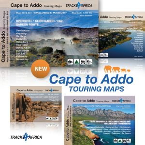
Get the full set!


 Tracks4Africa
Nick Harris (verified owner) –
Very user friendly and comprehensive. Will be using it on the road this weekend, but it has been invaluable for planning