
Product Description
Zimbabwe has long been the overlanding jewel of Southern Africa, and we’re excited to finally offer a dedicated paper map. Now, with the high-detail Zimbabwe Traveller’s Paper Map 1st Edition, you can plan your trip easily using marked points of interest, national parks, service towns, and connecting roads. Like our other maps, it includes time and distance indicators for efficient route planning.
You don’t need to transfer GPS coordinates manually because our T4A GPS Maps already include everything shown on the paper map. Therefore, you can use the T4A GPS Maps to navigate directly to every destination featured.
The map scale is 1:1 000 000. This gives you enough detail but also allows for an overview of the country.
Discover Zimbabwe: The Most Up-to-Date Tracks4Africa Paper Map for Self-Drive Travellers
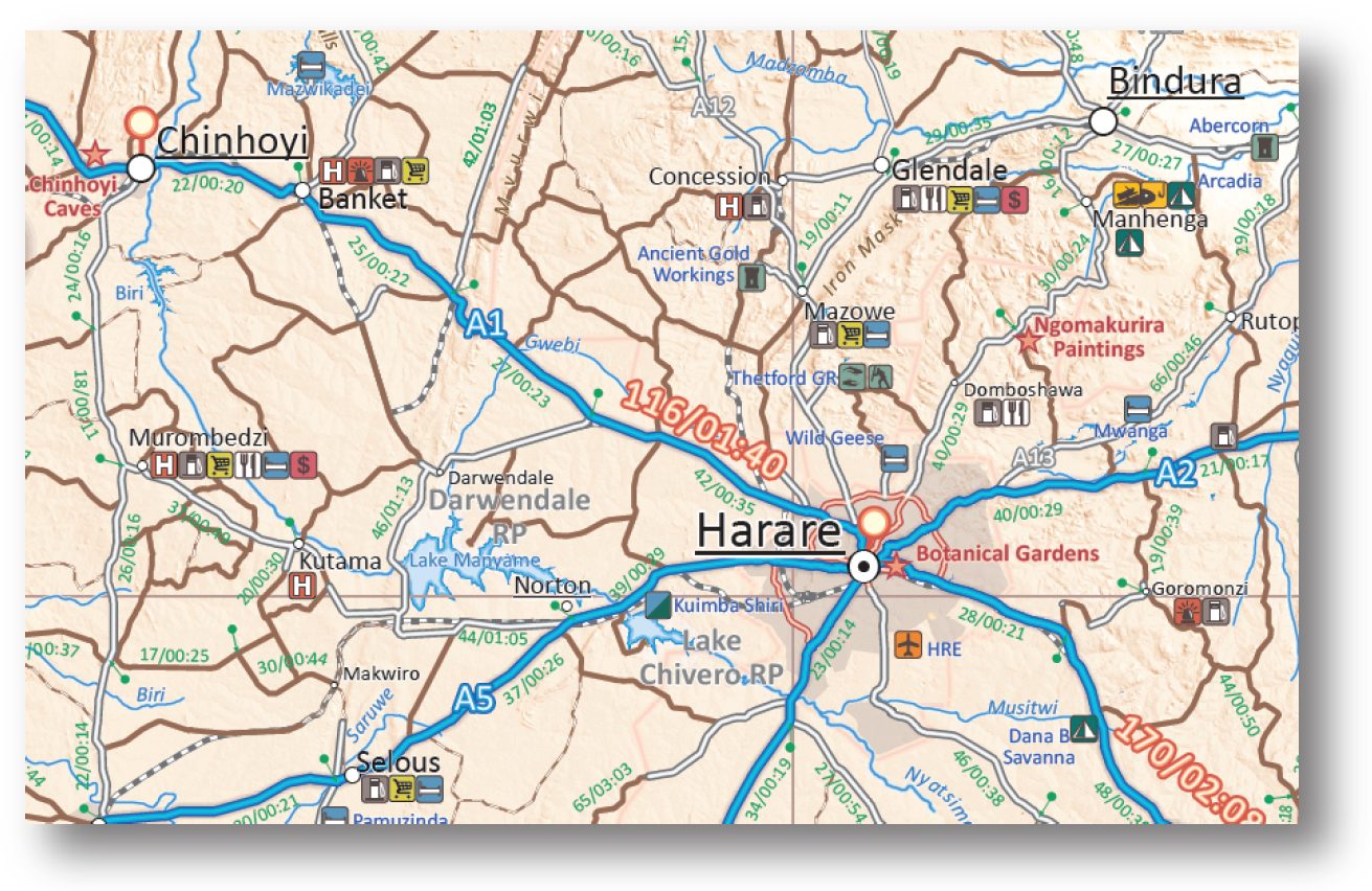
You’ll find all major and minor roads included, along with an extensive network of gravel and off-road tracks in rural areas.
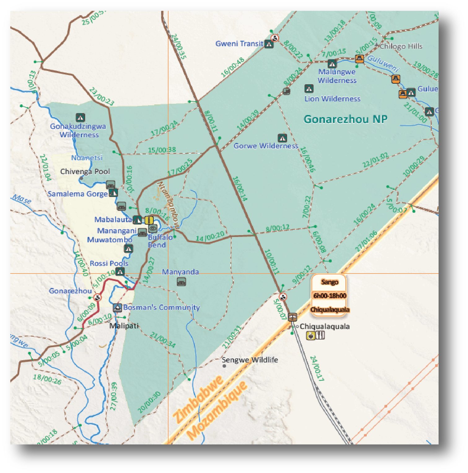
Additionally, the map covers all national parks. It features detailed inserts for prominent parks like Hwange, Gonarezhou, Zambezi Riverfront and Mana Pools National Park.
The Zimbabwe Traveller’s Paper Map 1st Edition also highlights major tourist attractions and landmarks.
Key features:
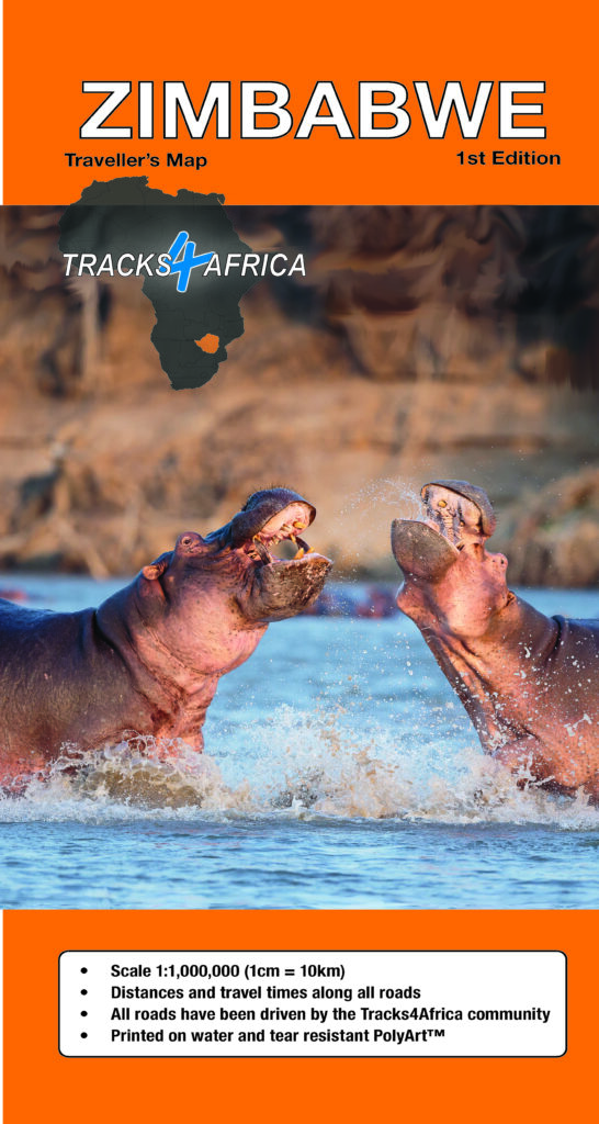
- Large 1:1,000,000 scale (large double-sided map)
Travel times and distances shown on roads - Large paper map, printed on both sides. It folds down to an easy-to-use size. Packed in a plastic sleeve for extra protection.
- When unfolded this Zimbabwe paper map is 1000x1265mm.
- What you see on the paper map is exactly what you get on T4A GPS Maps
- Comprehensive set of roads and tracks in nature reserves
- Map designed to suit the needs of self-drive travellers
- Border crossings indicated with opening and closing times
- Visit www.tracks4africa.com for detail on places of interest
- We print the map on durable PolyArt material. This material is tear and water resistant. Therefore, it will survive your adventures with you.
- Shaded relief background
Over the past 10 years, the Tracks4Africa community has collectively recorded and verified every road using GPS. As a result, the roads, tracks, places of interest, distance data, and travel time estimates on the Zimbabwe Traveller’s Paper Map 1st Edition, accurately reflect their real-world travel experience.
In fact, the T4A paper map series is likely the world’s first comprehensive country map to offer travel time information. This is true for the entire road network, whether on tar, gravel, or sand!
In addition to this, the Tracks4Africa research team has also driven every major road. They visited every single park in the country to verify details.


 Tracks4Africa
ken@burgesslandscapes.co.za (verified owner) –
Has everything one needs to put a trip together – and then very useful while travelling.
Eduard de Koning (verified owner) –
Speedy delivery and high quality map. Can’t wait to start using it, hopefully very soon!
AnthonyB (verified owner) –
Great detail and a fantastic planning tool, not to mention essential to have when in the middle of an overlanding adventure with no cell reception and a non-operational navigation device. Would not leave home without it!
Michael Gordon (verified owner) –
Purchased a few weeks ago. Very pleased with the product and incredible detail. Am using for route planning with T4A satnav and the new beta route planning product.
Butch Macdonald (verified owner) –
I have noticed that the Tugwi-Mukosi Dam which is Zimbabwe’s biggest Internal Dam after Kariba is not on the map – this dam spilled for the first time in 2021 and has become popular with Bass Fisherman
Janine Reyneke –
Thanks Butch – our GIS team is aware of this and fixing it.