


The Slingsby Overberg Whale Coast Paper Map map presents an attractive, double-sided layout featuring detailed street and area maps. It depicts relief using elevation tinting, spot heights, and 100-meter contour intervals. The map includes a variety of roads—from minor gravel and private roads to mountain passes—along with intermediate driving distances. Moreover, it clearly indicates routes that are particularly scenic or should be avoided. It also marks railways with local stations.
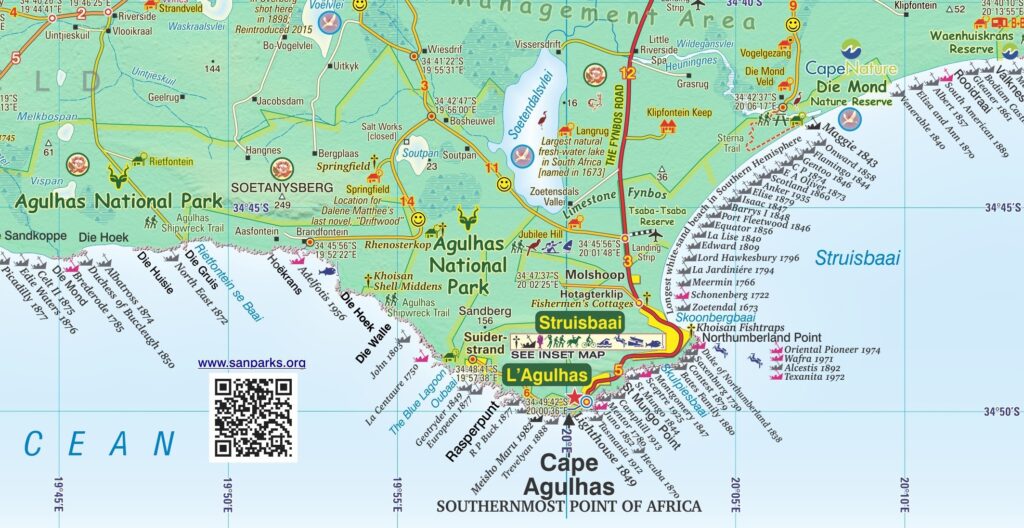
Side one extends from Somerset West along the coast to Cape Hangklip. It continues from Hermanus to Cape Agulhas and on eastwards to Port Beaufort/Witsand and the Breede River. Then the map goes north to Heidelberg, Barrydale and Montagu. From Robertson, it extends west to Villiersdorp and back to Stellenbosch.
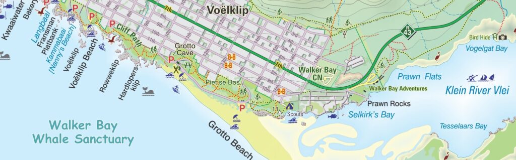
Side two includes enlarged inset maps of 24 of the larger towns in the region. These are at the greatly-enlarged scale of 1:25 000, or 4cm to the kilometre.
Extensive Features and Symbols
The Slingsby Overberg Whale Coast Paper Map uses symbols to represent a wide range of features. These include accommodation and camping sites, farm stalls and local produce shops like cheese, fish, and olives. Additionally, it highlights wine cellars, breweries, and outdoor recreation areas such as golf and paragliding. It also highlights landmarks, monuments, nature reserves, wildlife watching spots, botanical attractions, and wheelchair-friendly routes. Latitude and longitude lines appear at five-minute intervals for precise navigation.
Coastal Highlights and Marine History
A special focus on coastal areas enhances the Overberg Whale Coast Touring Paper Map. It includes details of the best beaches, yachting, diving, board sailing, and angling spots. Furthermore, it identifies prime whale-watching locations and numerous historic shipwreck sites, some dating back to the 17th century.
Insets and Additional Information
Inset maps at a 1:25,000 scale or larger surround the main map and appear on the reverse side. These detailed enlargements cover 25 towns and localities—including Hermanus, Bredasdorp, Betty’s Bay, Gansbaai, Kleinmond, Montagu, and Swellendam. These maps show relief, accommodations, petrol stations, and other facilities. The Overberg Whale Coast Touring Paper Map also provides contact details for further tourist information.
Key features:
- This double sided, full-relief map covers the whole of the official Overberg Tourism Region.
- We have based our detailed and beautifully drawn street maps on the latest available data to ensure accuracy.
- Water and tear resistant in plastic sleeve.
- To help you navigate with ease, we show all roads—from major National Highways to minor gravel paths. These routes come complete with accurate distance markings.
- In addition, we provide full GPS coordinates in DD MM SS format for every road junction. This allows you to pinpoint your location precisely.
- To enhance your journey, we use smiley icons to highlight the most scenic routes across the country on our Slingsby Overberg Whale Coast Paper Map.
- Moreover, we feature over 30 different types of attractions. These include farm stalls, abseiling, horse riding, golf courses, game viewing, botanical gardens, and historical sites.
- You will also find a wide selection of accommodation options, especially in off-the-beaten-path areas.
- For nature lovers, we pinpoint the best whale-watching spots and over 200 historic shipwreck sites along the coastline.
- Finally, to enrich your cultural experience, we include a unique key explaining the meanings of Khoisan place names throughout the region.


Reviews
There are no reviews yet.