
Product Description
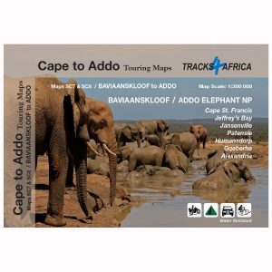
The Baviaanskloof Touring Digital Map is the most comprehensive, fully researched and detailed map of the Baviaanskloof ever published. Includes the new Leopard Trail and several interactive features.
How to Download Your Digital Maps
We supply our digital maps in 300 dpi JPG format, packaged as a single ZIP file (85 MB). Please be patient—large files take time to load.
After you complete checkout or send proof of EFT payment, you will automatically receive an email with download instructions. The JPG files are not password protected, so access is simple.
You may download each purchased ZIP file a maximum of two times.
Important Notes on Using Our Digital Maps
- Our digital maps are snapshots of our paper maps. They are not interactive—enlarging them or removing elements (e.g., title pane) does not reveal more mapped area. However, you can enlarge or reduce them within their 300 dpi resolution.
- iPhone users: Some iPhones store images in the Cloud, requiring downloads each time you access a map. To avoid this, consider installing a flash memory card so maps remain immediately available, even in areas without Wi-Fi or phone reception. This issue appears uncommon on Android devices, but user feedback is appreciated.
- Recommendation: Download your digital maps to a laptop or other hard drive before transferring them to a tablet or smartphone.
- Important: Digital products are non-returnable. Once delivered, we cannot verify whether files have been fully deleted from your devices—please understand and be fair.
Explore the Baviaanskloof Mega-Reserve
Navigate the Baviaanskloof Wilderness Area—set inland from the eastern end of the Garden Route—using this detailed, double-sided contoured Slingsby Baviaanskloof Touring Digital Map.
Understand the Landscape
Moreover, by using contours at 20-metre intervals and numerous spot heights, the map vividly depicts the region’s relief.
Plan Your Routes with Confidence
We classify roads by surface type, marking 4WD tracks, private sections, petrol stations, mountain passes, and intermediate distances on main routes. Railways with stations and major hiking trails also appear clearly on the Baviaanskloof Touring Digital Map.
Find Services and Points of Interest
Easy-to-read symbols highlight accommodation options, police stations, farm stalls, restaurants, monuments, museums, picnic sites, and information centres.
Navigate with Precision
Additionally, we mark reserve boundaries and include latitude and longitude lines at one-minute intervals on the Slingsby Baviaanskloof Touring Digital Map. Furthermore, GPS waypoints identify key road junctions for accurate positioning.
Key Features:
- The most up-to-date version of our famous Baviaanskloof map in digital format.
- The map covers the whole Kloof from near Willowmore in the west to Patensie and Hankey in the east
- Covering the full area, the Baviaanskloof Touring Digital Map stretches north to Cockscomb and continues south to the Long Kloof, providing complete coverage of the region..
- Indeed, as the only comprehensive map covering the entire Baviaanskloof Conservation Area—part of the Baviaanskloof Mega-Reserve and a World Heritage Site—it offers unmatched detail and coverage.
- All roads, tracks, paths and 4×4 routes are marked on the Slingsby Baviaanskloof Digital Map
- Kilometre distances are indicated between major intersections
- In addition, we provide full GPS coordinates in DD MM SS format for every road junction. This allows you to pinpoint your location precisely.
- With 20-metre contours and delicate colour shading, the map vividly brings the kloof’s extraordinary topography to life.
- All the latest tourism information, attractions and accommodation are on the map
- It now features the new Leopard Trail and adds several interactive elements to enhance your exploration.
- Contact details for all the places where you can stay are listed on the Baviaanskloof Digital Map.


 Tracks4Africa
Reviews
There are no reviews yet.