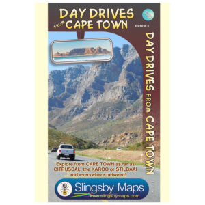
Product Description
Our Slingsby Day Drives from Cape Town Digital Map is the most comprehensive map available of the heartland of the Western Cape.
Side 1: Cape Town to the West Coast
Explore from Cape Town up the West Coast to Velddrif. With the help of our digital map focused on day drives, cross via Aurora and Piketberg to Citrusdal and the Kouebokkeveld. Travel east to Ceres, Worcester, Stanford, and Gansbaai. A handy Cape Peninsula enlargement at a 1:200 000 scale helps with detailed navigation.
Side 2: Tankwa to Cape Agulhas
With the Slingsby Day Drives from Cape Town Digital map, continue your journey through Touwsrivier to Laingsburg and the southern Tankwa. This map ensures you can head south via Calitzdorp, Ladismith, and Riversdale to Stilbaai. Then travel west to Cape Agulhas, Napier, McGregor, and Robertson—discovering top destinations along the way.
Key Features:
- Next, explore top tourist attractions and scenic routes, marked with smiley faces
- Then, follow all tar and gravel roads with accurate distance markers
- In addition, use GPS coordinates at every major junction (DDMMSS format)
- Moreover, enjoy plotted activities like mountain biking, hiking, horse riding, river rafting, golf, and more.
- Plus, discover nature reserves, farm stalls, historic sites, and other key attractions through our digital map, tailored for day drives.
- Finally, choose from a wide range of accommodation, from lodges and backpackers to campsites
How to Download Your Digital Maps
We supply our digital maps in 300 dpi JPG format, packaged as a single ZIP file (31 MB). Please be patient—large files take time to load.
After you complete checkout or send proof of EFT payment, you will automatically receive an email with download instructions. The JPG files are not password protected, so access is simple.
You may download each purchased ZIP file of our Day Drives from Cape Town Digital Map a maximum of two times.
Important Notes on Using Our Digital Maps
- Our digital maps are snapshots of our paper maps. They are not interactive—enlarging them or removing elements (e.g., title pane) does not reveal more mapped area. However, you can enlarge or reduce them within their 300 dpi resolution.
- iPhone users: Some iPhones store images in the Cloud, requiring downloads each time you access a map. To avoid this, consider installing a flash memory card so maps remain immediately available, even in areas without Wi-Fi or phone reception. This issue appears uncommon on Android devices, but user feedback is appreciated.
- Recommendation: Download your digital maps to a laptop or other hard drive before transferring them to a tablet or smartphone.
- Important: Digital products are non-returnable. Once delivered, we cannot verify whether files have been fully deleted from your devices—please understand and be fair.


Reviews
There are no reviews yet.