
TRACKSAFRICA OVERLANDER MAP – THE SOUTHERN & EASTERN AFRICA PAPER MAP EDITION 1 IS FOR DREAMERS, ADVENTURE SEEKERS, AND THOSE WHO YEARN TO EXPERIENCE AFRICA’S RUGGED WILDERNESS BY VEHICLE.
With over 25 years of mapping and overland travel experience, we bring you a map designed from an overlander’s perspective of Southern and Eastern Africa. Although it also covers parts of Central Africa, most key routes and destinations focus on the Southern and Eastern regions.
Over the past 10 years, the Tracks4Africa community has actively recorded and GPS-verified every road. As a result, the roads, tracks, and points of interest on the Southern & Eastern Africa Paper Map Edition 1 accurately reflect real-world travel experience.

Note: the Southern & Eastern Africa Paper Map does NOT include travel times and distances like our country maps.
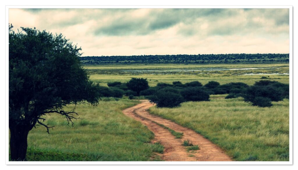
The Southern & Eastern Africa Map was intentionally designed as a broad overview map – a “dreamer’s map” for exploring possibilities and planning journeys across the region.
At this scale, it is not intended for detailed route planning. Although we have the relevant travel-time data, including it would make the map overly busy without adding sufficient value.
For more detailed planning, our individual country maps are produced at a larger scale of 1:1 million and include travel times and distances.
Key features:
- The S&E Africa paper map covers: Angola, Botswana, Burundi, DRC, Eswatini, Kenya, Lesotho, Mozambique, Malawi, Namibia, Rwanda, South Africa, Tanzania, Uganda, Zambia, Zimbabwe.
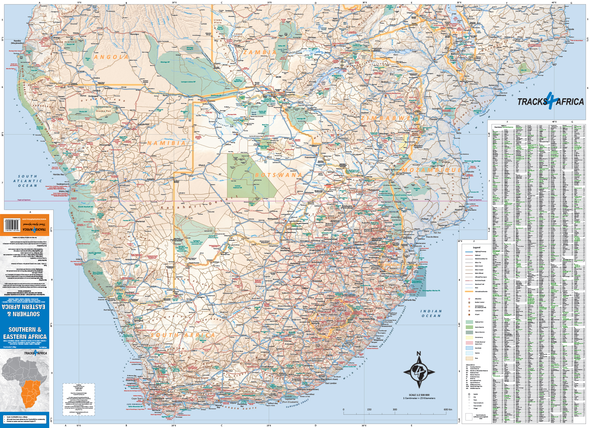
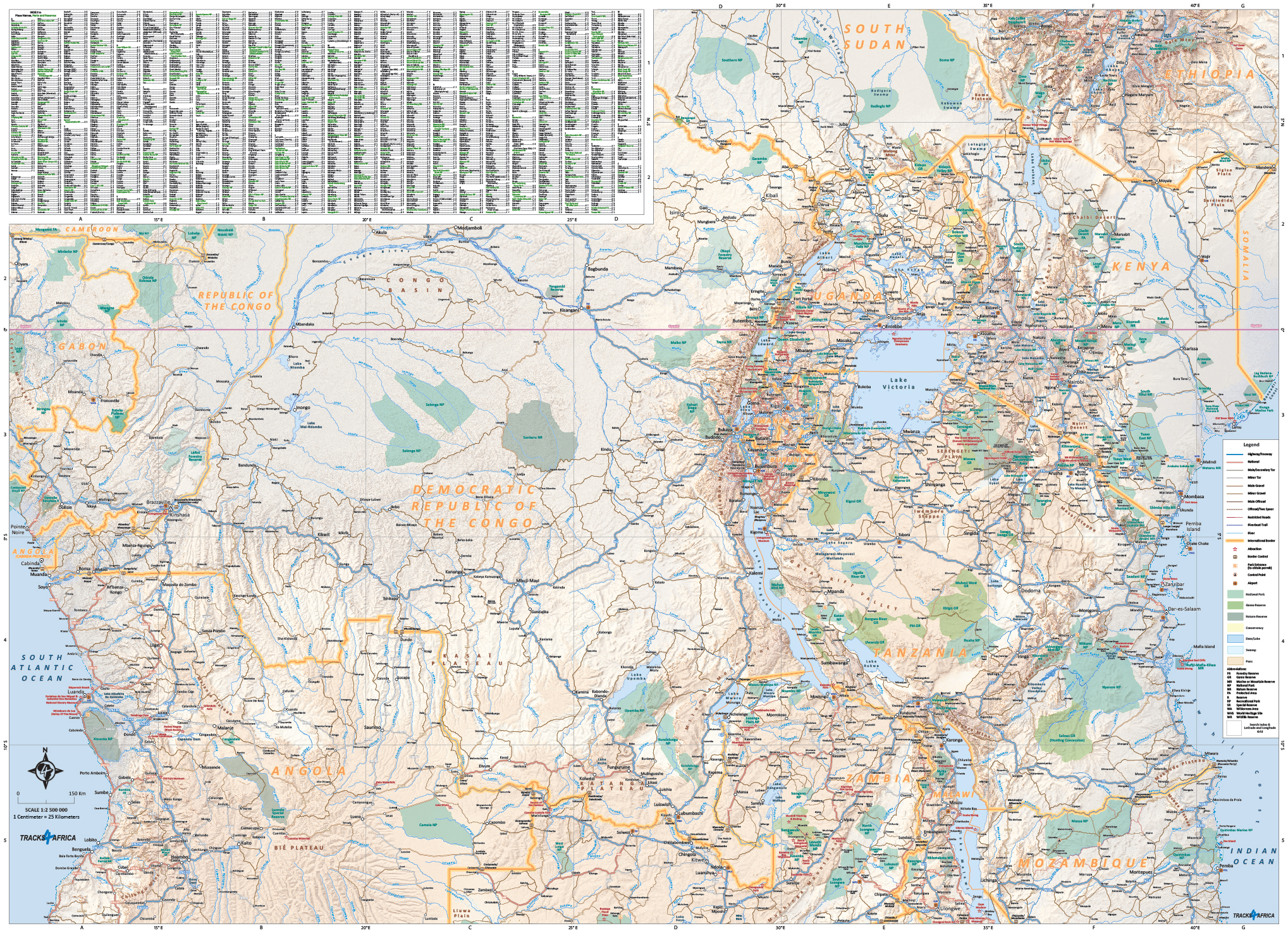
- Large 1:2.5 million scale (ideal for macro planning extended trips or tracking your adventures)
- This large paper map prints on both sides and folds down to a convenient, easy-to-use size. It also comes in a plastic sleeve for added protection.
- When unfolded the Southern & Eastern Africa Paper Map Edition 1 is 1000 x 1380 mm.
- What you see on the S&E Africa Paper Map matches exactly what you get on the T4A GPS Maps, ensuring seamless navigation between paper and GPS.
- Major Tourist Attractions: Discover iconic landmarks and must-see destinations.
- Map designed to suit the needs of self-drive travellers
- National Parks and Game Reserves: Explore Africa’s renowned wildlife sanctuaries.
- Visit www.tracks4africa.com for detail on places of interest
- We print the S&E paper map on durable PolyArt material. This material is tear and water resistant. Therefore, it will survive your adventures with you.
- Road Network: Navigate with confidence using our detailed road classifications, from highways to 4WD tracks.
- International Airports and Border Posts: Plan your entry and exit points with ease.
- Relief Shading: Visualize the landscape with textured terrain.
Actual Size Sample:
Southern Sheet:
Northern Sheet:


 Tracks4Africa
CD James (verified owner) –
Whilst the quality of the waterproof, fold-proof paper is appreciated, the map itself appears outdated and does not show distances between towns. Yes it is a scale map but manually calculating distances using a pair of protractors with the map open on your dashboard or lap is not ideal…
Janine Reyneke –
Clive, thank you for your support and honest review! Our map was revised and printed in 2025 – its definately not outdated. The Southern & Eastern Africa Paper Map is an overlander overview map at a scale of 1:1.25 million. Unlike our individual country maps, it does not include travel times and distances, as noted on the product page.
The map covers a vast area, including Angola, Botswana, Burundi, the DRC, Eswatini, Kenya, Lesotho, Malawi, Mozambique, Namibia, Rwanda, South Africa, Tanzania, Uganda, Zambia and Zimbabwe. Adding travel times and distances across such a large region would make the map extremely busy and difficult to read.
It was intentionally designed as an inspirational overview map — a “dreamer’s map” for exploring routes and planning broader journeys. At this scale, the map is not intended for detailed trip planning, and we felt that including travel times would add clutter rather than meaningful value.
Our individual country maps, which are generally produced at the more detailed scale of 1:1 million, are better suited to detailed planning and therefore include travel times and distances.
Although we do have the relevant data, the decision was made not to include it on this map in order to preserve clarity and ease of use.